You are here: Home > Network List > US - United States National Seismic Network Stations List
> Station NEW Newport, Washington, USA > Earthquake Result Viewer
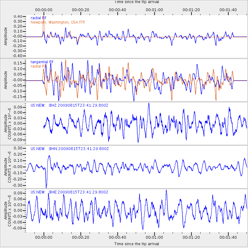
NEW Newport, Washington, USA - Earthquake Result Viewer
*The percent match for this event was below the threshold and hence no stack was calculated.
| Earthquake location: |
Fiji Islands Region |
| Earthquake latitude/longitude: |
-19.8/-178.2 |
| Earthquake time(UTC): |
2009/08/15 (227) 23:30:19 GMT |
| Earthquake Depth: |
608 km |
| Earthquake Magnitude: |
5.6 MW, 5.2 MB |
| Earthquake Catalog/Contributor: |
WHDF/NEIC |
|
| Network: |
US United States National Seismic Network |
| Station: |
NEW Newport, Washington, USA |
| Lat/Lon: |
48.26 N/117.12 W |
| Elevation: |
760 m |
|
| Distance: |
87.0 deg |
| Az: |
35.867 deg |
| Baz: |
235.641 deg |
| Ray Param: |
$rayparam |
*The percent match for this event was below the threshold and hence was not used in the summary stack. |
|
| Radial Match: |
66.47484 % |
| Radial Bump: |
400 |
| Transverse Match: |
50.56366 % |
| Transverse Bump: |
400 |
| SOD ConfigId: |
2622 |
| Insert Time: |
2010-03-05 01:47:31.511 +0000 |
| GWidth: |
2.5 |
| Max Bumps: |
400 |
| Tol: |
0.001 |
|
Signal To Noise
| Channel | StoN | STA | LTA |
| US:NEW: :BHN:20090815T23:41:29.800Z | 3.321919 | 1.313122E-7 | 3.9529024E-8 |
| US:NEW: :BHE:20090815T23:41:29.800Z | 1.1716566 | 3.472612E-8 | 2.963848E-8 |
| US:NEW: :BHZ:20090815T23:41:29.800Z | 1.1791377 | 3.4493866E-8 | 2.9253467E-8 |
| Arrivals |
| Ps | |
| PpPs | |
| PsPs/PpSs | |


