You are here: Home > Network List > TA - USArray Transportable Network (new EarthScope stations) Stations List
> Station I23K Minto, Yukon-Koyukuk, AK, USA > Earthquake Result Viewer
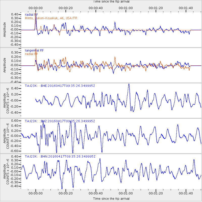
I23K Minto, Yukon-Koyukuk, AK, USA - Earthquake Result Viewer
*The percent match for this event was below the threshold and hence no stack was calculated.
| Earthquake location: |
Near Coast Of Ecuador |
| Earthquake latitude/longitude: |
-0.3/-80.7 |
| Earthquake time(UTC): |
2016/04/17 (108) 09:23:40 GMT |
| Earthquake Depth: |
10 km |
| Earthquake Magnitude: |
5.5 MB |
| Earthquake Catalog/Contributor: |
NEIC PDE/NEIC COMCAT |
|
| Network: |
TA USArray Transportable Network (new EarthScope stations) |
| Station: |
I23K Minto, Yukon-Koyukuk, AK, USA |
| Lat/Lon: |
65.15 N/149.36 W |
| Elevation: |
149 m |
|
| Distance: |
81.4 deg |
| Az: |
336.541 deg |
| Baz: |
109.614 deg |
| Ray Param: |
$rayparam |
*The percent match for this event was below the threshold and hence was not used in the summary stack. |
|
| Radial Match: |
51.1309 % |
| Radial Bump: |
400 |
| Transverse Match: |
45.117752 % |
| Transverse Bump: |
400 |
| SOD ConfigId: |
7422571 |
| Insert Time: |
2019-04-22 08:48:34.965 +0000 |
| GWidth: |
2.5 |
| Max Bumps: |
400 |
| Tol: |
0.001 |
|
Signal To Noise
| Channel | StoN | STA | LTA |
| TA:I23K: :BHZ:20160417T09:35:26.349995Z | 2.3607004 | 3.0499277E-7 | 1.2919587E-7 |
| TA:I23K: :BHN:20160417T09:35:26.349995Z | 1.2383802 | 1.1845347E-7 | 9.565194E-8 |
| TA:I23K: :BHE:20160417T09:35:26.349995Z | 1.055253 | 1.1611066E-7 | 1.1003111E-7 |
| Arrivals |
| Ps | |
| PpPs | |
| PsPs/PpSs | |


