You are here: Home > Network List > TA - USArray Transportable Network (new EarthScope stations) Stations List
> Station M31M Drury Creek, Yukon, CA > Earthquake Result Viewer
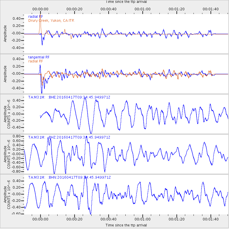
M31M Drury Creek, Yukon, CA - Earthquake Result Viewer
*The percent match for this event was below the threshold and hence no stack was calculated.
| Earthquake location: |
Near Coast Of Ecuador |
| Earthquake latitude/longitude: |
-0.3/-80.7 |
| Earthquake time(UTC): |
2016/04/17 (108) 09:23:40 GMT |
| Earthquake Depth: |
10 km |
| Earthquake Magnitude: |
5.5 MB |
| Earthquake Catalog/Contributor: |
NEIC PDE/NEIC COMCAT |
|
| Network: |
TA USArray Transportable Network (new EarthScope stations) |
| Station: |
M31M Drury Creek, Yukon, CA |
| Lat/Lon: |
62.20 N/134.39 W |
| Elevation: |
639 m |
|
| Distance: |
74.1 deg |
| Az: |
336.877 deg |
| Baz: |
123.105 deg |
| Ray Param: |
$rayparam |
*The percent match for this event was below the threshold and hence was not used in the summary stack. |
|
| Radial Match: |
71.15951 % |
| Radial Bump: |
400 |
| Transverse Match: |
65.58396 % |
| Transverse Bump: |
400 |
| SOD ConfigId: |
7422571 |
| Insert Time: |
2019-04-22 08:48:46.991 +0000 |
| GWidth: |
2.5 |
| Max Bumps: |
400 |
| Tol: |
0.001 |
|
Signal To Noise
| Channel | StoN | STA | LTA |
| TA:M31M: :BHZ:20160417T09:34:45.949971Z | 1.3475945 | 3.881128E-7 | 2.8800414E-7 |
| TA:M31M: :BHN:20160417T09:34:45.949971Z | 1.2828591 | 2.6213456E-7 | 2.0433622E-7 |
| TA:M31M: :BHE:20160417T09:34:45.949971Z | 2.2301857 | 3.8289227E-7 | 1.7168627E-7 |
| Arrivals |
| Ps | |
| PpPs | |
| PsPs/PpSs | |


