You are here: Home > Network List > TA - USArray Transportable Network (new EarthScope stations) Stations List
> Station M53A WI Miller and Sons, Farmdale, OH, USA > Earthquake Result Viewer
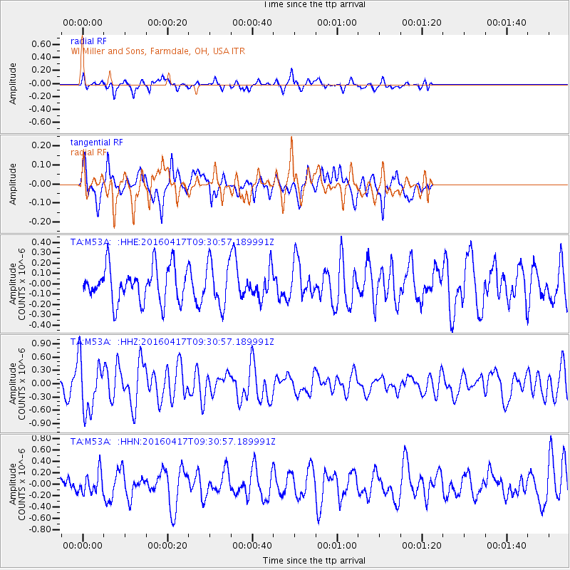
M53A WI Miller and Sons, Farmdale, OH, USA - Earthquake Result Viewer
*The percent match for this event was below the threshold and hence no stack was calculated.
| Earthquake location: |
Near Coast Of Ecuador |
| Earthquake latitude/longitude: |
-0.3/-80.7 |
| Earthquake time(UTC): |
2016/04/17 (108) 09:23:40 GMT |
| Earthquake Depth: |
10 km |
| Earthquake Magnitude: |
5.5 MB |
| Earthquake Catalog/Contributor: |
NEIC PDE/NEIC COMCAT |
|
| Network: |
TA USArray Transportable Network (new EarthScope stations) |
| Station: |
M53A WI Miller and Sons, Farmdale, OH, USA |
| Lat/Lon: |
41.44 N/80.68 W |
| Elevation: |
334 m |
|
| Distance: |
41.5 deg |
| Az: |
0.047 deg |
| Baz: |
180.062 deg |
| Ray Param: |
$rayparam |
*The percent match for this event was below the threshold and hence was not used in the summary stack. |
|
| Radial Match: |
50.405903 % |
| Radial Bump: |
376 |
| Transverse Match: |
57.904907 % |
| Transverse Bump: |
356 |
| SOD ConfigId: |
7422571 |
| Insert Time: |
2019-04-22 08:48:47.353 +0000 |
| GWidth: |
2.5 |
| Max Bumps: |
400 |
| Tol: |
0.001 |
|
Signal To Noise
| Channel | StoN | STA | LTA |
| TA:M53A: :HHZ:20160417T09:30:57.189991Z | 2.3567443 | 5.8434745E-7 | 2.479469E-7 |
| TA:M53A: :HHN:20160417T09:30:57.189991Z | 1.0559866 | 1.8441395E-7 | 1.7463663E-7 |
| TA:M53A: :HHE:20160417T09:30:57.189991Z | 1.3347383 | 2.229971E-7 | 1.6707178E-7 |
| Arrivals |
| Ps | |
| PpPs | |
| PsPs/PpSs | |


