You are here: Home > Network List > US - United States National Seismic Network Stations List
> Station NEW Newport, Washington, USA > Earthquake Result Viewer
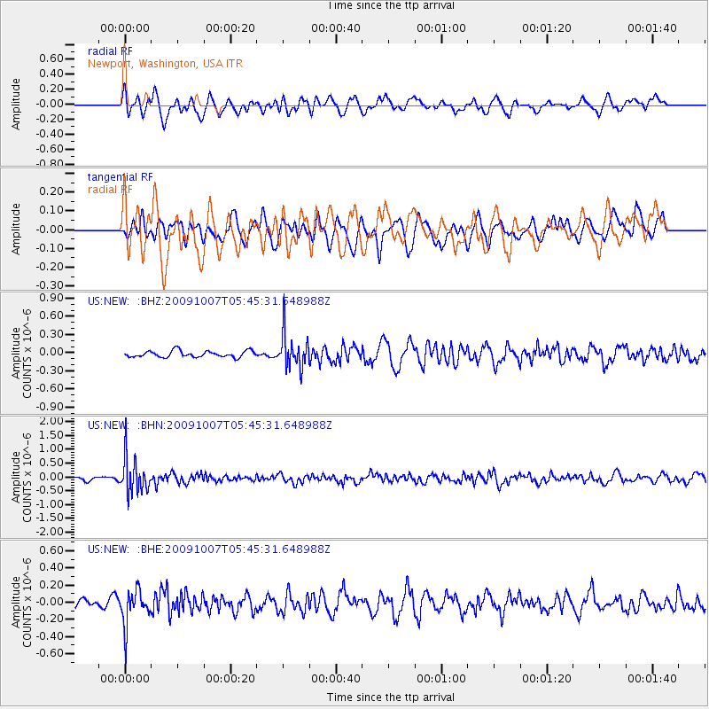
NEW Newport, Washington, USA - Earthquake Result Viewer
*The percent match for this event was below the threshold and hence no stack was calculated.
| Earthquake location: |
Rat Islands, Aleutian Islands |
| Earthquake latitude/longitude: |
52.2/178.1 |
| Earthquake time(UTC): |
2009/10/07 (280) 05:38:37 GMT |
| Earthquake Depth: |
138 km |
| Earthquake Magnitude: |
5.6 MB, 5.6 MW, 5.6 MW |
| Earthquake Catalog/Contributor: |
WHDF/NEIC |
|
| Network: |
US United States National Seismic Network |
| Station: |
NEW Newport, Washington, USA |
| Lat/Lon: |
48.26 N/117.12 W |
| Elevation: |
760 m |
|
| Distance: |
40.4 deg |
| Az: |
68.807 deg |
| Baz: |
300.725 deg |
| Ray Param: |
$rayparam |
*The percent match for this event was below the threshold and hence was not used in the summary stack. |
|
| Radial Match: |
62.821827 % |
| Radial Bump: |
400 |
| Transverse Match: |
45.554073 % |
| Transverse Bump: |
400 |
| SOD ConfigId: |
2622 |
| Insert Time: |
2010-03-05 01:47:48.347 +0000 |
| GWidth: |
2.5 |
| Max Bumps: |
400 |
| Tol: |
0.001 |
|
Signal To Noise
| Channel | StoN | STA | LTA |
| US:NEW: :BHN:20091007T05:45:31.648988Z | 6.9899487 | 6.318444E-7 | 9.039328E-8 |
| US:NEW: :BHE:20091007T05:45:31.648988Z | 2.8592944 | 2.0438034E-7 | 7.14793E-8 |
| US:NEW: :BHZ:20091007T05:45:31.648988Z | 5.4880123 | 2.8258316E-7 | 5.149099E-8 |
| Arrivals |
| Ps | |
| PpPs | |
| PsPs/PpSs | |


