You are here: Home > Network List > US - United States National Seismic Network Stations List
> Station NEW Newport, Washington, USA > Earthquake Result Viewer
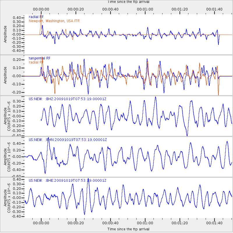
NEW Newport, Washington, USA - Earthquake Result Viewer
*The percent match for this event was below the threshold and hence no stack was calculated.
| Earthquake location: |
Samoa Islands Region |
| Earthquake latitude/longitude: |
-15.4/-173.0 |
| Earthquake time(UTC): |
2009/10/19 (292) 07:41:38 GMT |
| Earthquake Depth: |
10 km |
| Earthquake Magnitude: |
5.8 MW, 5.4 MS, 5.4 MB, 5.8 MW |
| Earthquake Catalog/Contributor: |
WHDF/NEIC |
|
| Network: |
US United States National Seismic Network |
| Station: |
NEW Newport, Washington, USA |
| Lat/Lon: |
48.26 N/117.12 W |
| Elevation: |
760 m |
|
| Distance: |
80.5 deg |
| Az: |
34.104 deg |
| Baz: |
234.02 deg |
| Ray Param: |
$rayparam |
*The percent match for this event was below the threshold and hence was not used in the summary stack. |
|
| Radial Match: |
51.495518 % |
| Radial Bump: |
400 |
| Transverse Match: |
60.186707 % |
| Transverse Bump: |
400 |
| SOD ConfigId: |
2622 |
| Insert Time: |
2010-03-05 01:47:51.839 +0000 |
| GWidth: |
2.5 |
| Max Bumps: |
400 |
| Tol: |
0.001 |
|
Signal To Noise
| Channel | StoN | STA | LTA |
| US:NEW: :BHN:20091019T07:53:19.00001Z | 2.9523785 | 3.0562194E-7 | 1.0351719E-7 |
| US:NEW: :BHE:20091019T07:53:19.00001Z | 0.5272054 | 6.735558E-8 | 1.2775966E-7 |
| US:NEW: :BHZ:20091019T07:53:19.00001Z | 1.2023602 | 1.5767004E-7 | 1.3113379E-7 |
| Arrivals |
| Ps | |
| PpPs | |
| PsPs/PpSs | |


