You are here: Home > Network List > US - United States National Seismic Network Stations List
> Station NEW Newport, Washington, USA > Earthquake Result Viewer
NEW Newport, Washington, USA - Earthquake Result Viewer
*The percent match for this event was below the threshold and hence no stack was calculated.
| Earthquake location: |
Mariana Islands |
| Earthquake latitude/longitude: |
19.1/145.8 |
| Earthquake time(UTC): |
2008/12/02 (337) 12:31:43 GMT |
| Earthquake Depth: |
137 km |
| Earthquake Magnitude: |
5.9 MB, 5.9 MW, 5.9 MW |
| Earthquake Catalog/Contributor: |
WHDF/NEIC |
|
| Network: |
US United States National Seismic Network |
| Station: |
NEW Newport, Washington, USA |
| Lat/Lon: |
48.26 N/117.12 W |
| Elevation: |
760 m |
|
| Distance: |
80.6 deg |
| Az: |
42.229 deg |
| Baz: |
287.993 deg |
| Ray Param: |
$rayparam |
*The percent match for this event was below the threshold and hence was not used in the summary stack. |
|
| Radial Match: |
52.378292 % |
| Radial Bump: |
400 |
| Transverse Match: |
52.770832 % |
| Transverse Bump: |
375 |
| SOD ConfigId: |
2658 |
| Insert Time: |
2010-03-05 01:48:02.318 +0000 |
| GWidth: |
2.5 |
| Max Bumps: |
400 |
| Tol: |
0.001 |
|
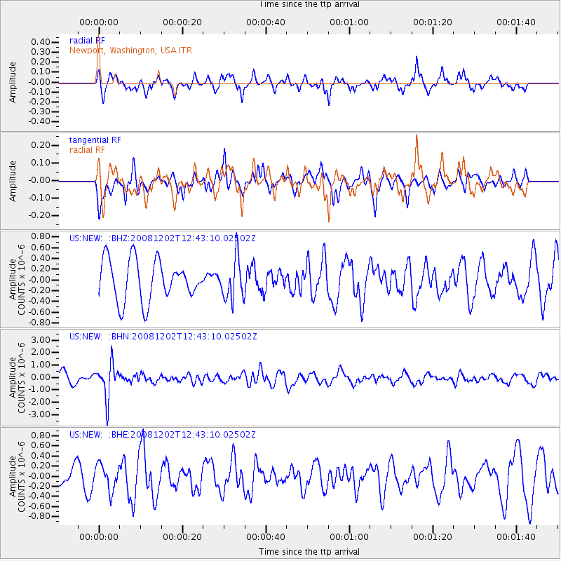
Signal To Noise
| Channel | StoN | STA | LTA |
| US:NEW: :BHN:20081202T12:43:10.02502Z | 3.882006 | 1.3603934E-6 | 3.504357E-7 |
| US:NEW: :BHE:20081202T12:43:10.02502Z | 1.0359954 | 2.558516E-7 | 2.4696212E-7 |
| US:NEW: :BHZ:20081202T12:43:10.02502Z | 1.0199742 | 3.8515648E-7 | 3.7761396E-7 |
| Arrivals |
| Ps | |
| PpPs | |
| PsPs/PpSs | |


