You are here: Home > Network List > US - United States National Seismic Network Stations List
> Station NEW Newport, Washington, USA > Earthquake Result Viewer
NEW Newport, Washington, USA - Earthquake Result Viewer
*The percent match for this event was below the threshold and hence no stack was calculated.
| Earthquake location: |
Northwest Of Ryukyu Islands |
| Earthquake latitude/longitude: |
27.4/126.7 |
| Earthquake time(UTC): |
2009/03/26 (085) 19:19:59 GMT |
| Earthquake Depth: |
160 km |
| Earthquake Magnitude: |
5.6 MB, 5.9 MW, 5.9 MW |
| Earthquake Catalog/Contributor: |
WHDF/NEIC |
|
| Network: |
US United States National Seismic Network |
| Station: |
NEW Newport, Washington, USA |
| Lat/Lon: |
48.26 N/117.12 W |
| Elevation: |
760 m |
|
| Distance: |
85.5 deg |
| Az: |
36.979 deg |
| Baz: |
306.846 deg |
| Ray Param: |
$rayparam |
*The percent match for this event was below the threshold and hence was not used in the summary stack. |
|
| Radial Match: |
59.81198 % |
| Radial Bump: |
400 |
| Transverse Match: |
62.198296 % |
| Transverse Bump: |
400 |
| SOD ConfigId: |
2658 |
| Insert Time: |
2010-03-05 01:48:24.449 +0000 |
| GWidth: |
2.5 |
| Max Bumps: |
400 |
| Tol: |
0.001 |
|
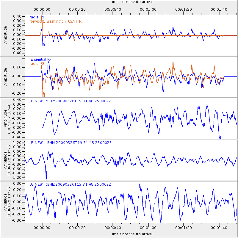
Signal To Noise
| Channel | StoN | STA | LTA |
| US:NEW: :BHN:20090326T19:31:48.250002Z | 2.8218558 | 4.7583868E-7 | 1.6862616E-7 |
| US:NEW: :BHE:20090326T19:31:48.250002Z | 0.97369874 | 1.0040991E-7 | 1.03122154E-7 |
| US:NEW: :BHZ:20090326T19:31:48.250002Z | 0.62104356 | 8.197773E-8 | 1.3199997E-7 |
| Arrivals |
| Ps | |
| PpPs | |
| PsPs/PpSs | |


