You are here: Home > Network List > IU - Global Seismograph Network (GSN - IRIS/USGS) Stations List
> Station JOHN Johnston Island, USA > Earthquake Result Viewer
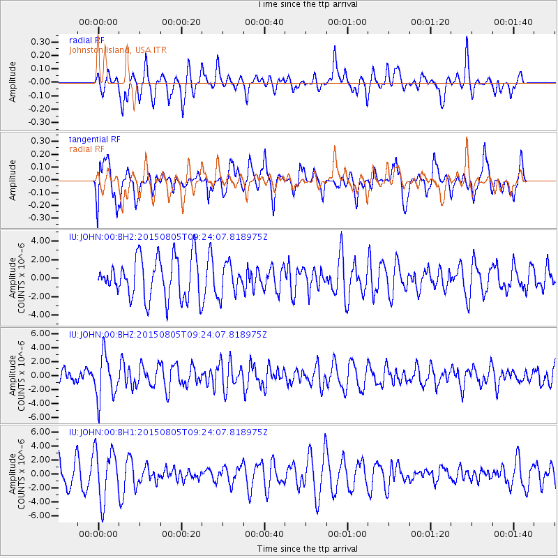
JOHN Johnston Island, USA - Earthquake Result Viewer
*The percent match for this event was below the threshold and hence no stack was calculated.
| Earthquake location: |
Chiapas, Mexico |
| Earthquake latitude/longitude: |
16.2/-93.6 |
| Earthquake time(UTC): |
2015/08/05 (217) 09:13:24 GMT |
| Earthquake Depth: |
110 km |
| Earthquake Magnitude: |
5.7 MWB |
| Earthquake Catalog/Contributor: |
NEIC PDE/NEIC COMCAT |
|
| Network: |
IU Global Seismograph Network (GSN - IRIS/USGS) |
| Station: |
JOHN Johnston Island, USA |
| Lat/Lon: |
16.73 N/169.53 W |
| Elevation: |
2.0 m |
|
| Distance: |
72.3 deg |
| Az: |
282.758 deg |
| Baz: |
77.998 deg |
| Ray Param: |
$rayparam |
*The percent match for this event was below the threshold and hence was not used in the summary stack. |
|
| Radial Match: |
56.03038 % |
| Radial Bump: |
364 |
| Transverse Match: |
54.093464 % |
| Transverse Bump: |
400 |
| SOD ConfigId: |
1085051 |
| Insert Time: |
2015-08-19 09:20:42.824 +0000 |
| GWidth: |
2.5 |
| Max Bumps: |
400 |
| Tol: |
0.001 |
|
Signal To Noise
| Channel | StoN | STA | LTA |
| IU:JOHN:00:BHZ:20150805T09:24:07.818975Z | 2.0671592 | 3.2113335E-6 | 1.5535009E-6 |
| IU:JOHN:00:BH1:20150805T09:24:07.818975Z | 1.9472998 | 3.6486247E-6 | 1.873684E-6 |
| IU:JOHN:00:BH2:20150805T09:24:07.818975Z | 0.7383285 | 1.6227654E-6 | 2.1978906E-6 |
| Arrivals |
| Ps | |
| PpPs | |
| PsPs/PpSs | |


