MCWV Mont Chateau, West Virginia, USA - Earthquake Result Viewer
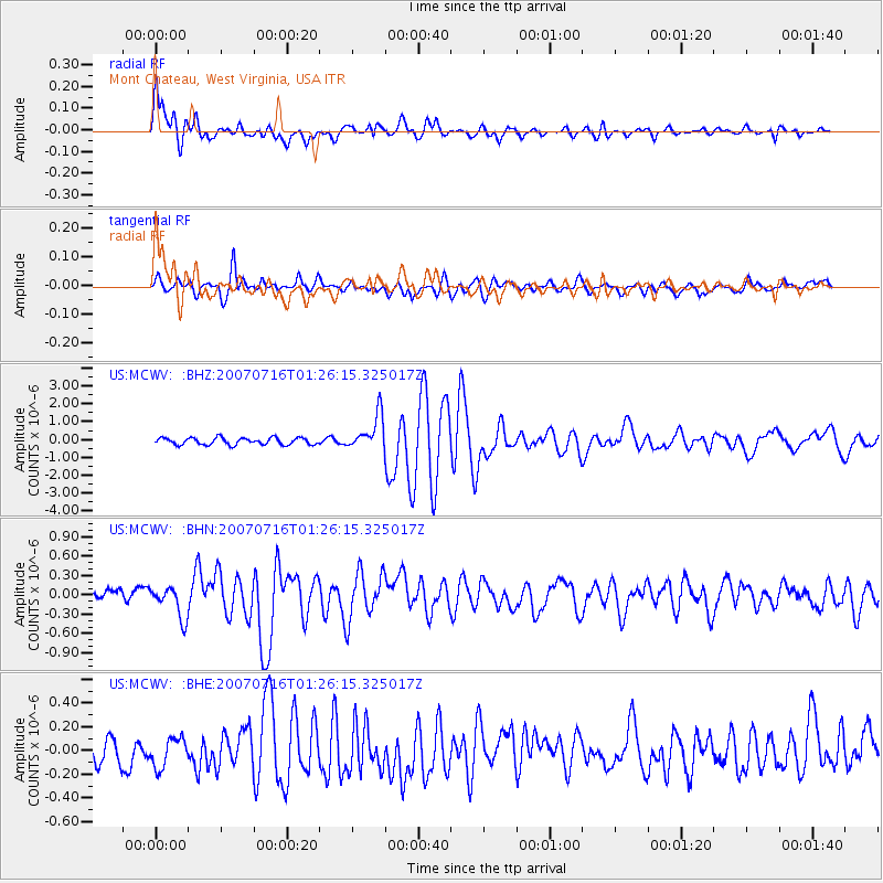
Earthquake location: Near West Coast Of Honshu, Japan
Earthquake latitude/longitude: 37.5/138.4
Earthquake time(UTC): 2007/07/16 (197) 01:13:22 GMT
Earthquake Depth: 12 km
Earthquake Magnitude: 6.5 MB, 6.4 MS, 6.6 MW, 6.5 MW
Earthquake Catalog/Contributor: WHDF/NEIC
Network: US United States National Seismic Network
Station: MCWV Mont Chateau, West Virginia, USA
Lat/Lon: 39.66 N/79.85 W
Elevation: 280 m
Distance: 95.5 deg
Az: 28.723 deg
Baz: 330.338 deg
Ray Param: 0.040762097
Estimated Moho Depth: 35.0 km
Estimated Crust Vp/Vs: 2.06
Assumed Crust Vp: 6.159 km/s
Estimated Crust Vs: 2.993 km/s
Estimated Crust Poisson's Ratio: 0.35
Radial Match: 88.070435 %
Radial Bump: 400
Transverse Match: 82.8908 %
Transverse Bump: 400
SOD ConfigId: 2564
Insert Time: 2010-03-05 01:50:30.784 +0000
GWidth: 2.5
Max Bumps: 400
Tol: 0.001

Signal To Noise

ChannelStoNSTALTA
US:MCWV: :BHN:20070716T01:26:15.325017Z2.41595912.3861568E-79.8766435E-8
US:MCWV: :BHE:20070716T01:26:15.325017Z1.28099171.2459111E-79.726145E-8
US:MCWV: :BHZ:20070716T01:26:15.325017Z5.10508549.745531E-71.9089849E-7
Arrivals
Ps6.1 SECOND
PpPs17 SECOND
PsPs/PpSs23 SECOND