You are here: Home > Network List > WY - Yellowstone Wyoming Seismic Network Stations List
> Station YHH Holmes Hill, YNP, WY, USA > Earthquake Result Viewer
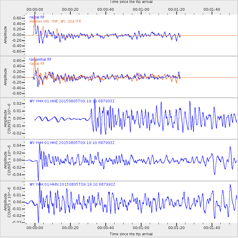
YHH Holmes Hill, YNP, WY, USA - Earthquake Result Viewer
*The percent match for this event was below the threshold and hence no stack was calculated.
| Earthquake location: |
Chiapas, Mexico |
| Earthquake latitude/longitude: |
16.2/-93.6 |
| Earthquake time(UTC): |
2015/08/05 (217) 09:13:24 GMT |
| Earthquake Depth: |
110 km |
| Earthquake Magnitude: |
5.7 MWB |
| Earthquake Catalog/Contributor: |
NEIC PDE/NEIC COMCAT |
|
| Network: |
WY Yellowstone Wyoming Seismic Network |
| Station: |
YHH Holmes Hill, YNP, WY, USA |
| Lat/Lon: |
44.79 N/110.85 W |
| Elevation: |
2717 m |
|
| Distance: |
32.0 deg |
| Az: |
336.563 deg |
| Baz: |
147.537 deg |
| Ray Param: |
$rayparam |
*The percent match for this event was below the threshold and hence was not used in the summary stack. |
|
| Radial Match: |
69.04158 % |
| Radial Bump: |
400 |
| Transverse Match: |
68.752464 % |
| Transverse Bump: |
400 |
| SOD ConfigId: |
1085051 |
| Insert Time: |
2015-08-19 09:24:43.533 +0000 |
| GWidth: |
2.5 |
| Max Bumps: |
400 |
| Tol: |
0.001 |
|
Signal To Noise
| Channel | StoN | STA | LTA |
| WY:YHH:01:HHZ:20150805T09:19:10.687993Z | 16.94437 | 2.0911093E-8 | 1.2341027E-9 |
| WY:YHH:01:HHN:20150805T09:19:10.687993Z | 9.621997 | 1.1718204E-8 | 1.2178558E-9 |
| WY:YHH:01:HHE:20150805T09:19:10.687993Z | 6.2587943 | 1.0385213E-8 | 1.6592993E-9 |
| Arrivals |
| Ps | |
| PpPs | |
| PsPs/PpSs | |


