You are here: Home > Network List > TA - USArray Transportable Network (new EarthScope stations) Stations List
> Station J20K Nowitna River, AK, USA > Earthquake Result Viewer
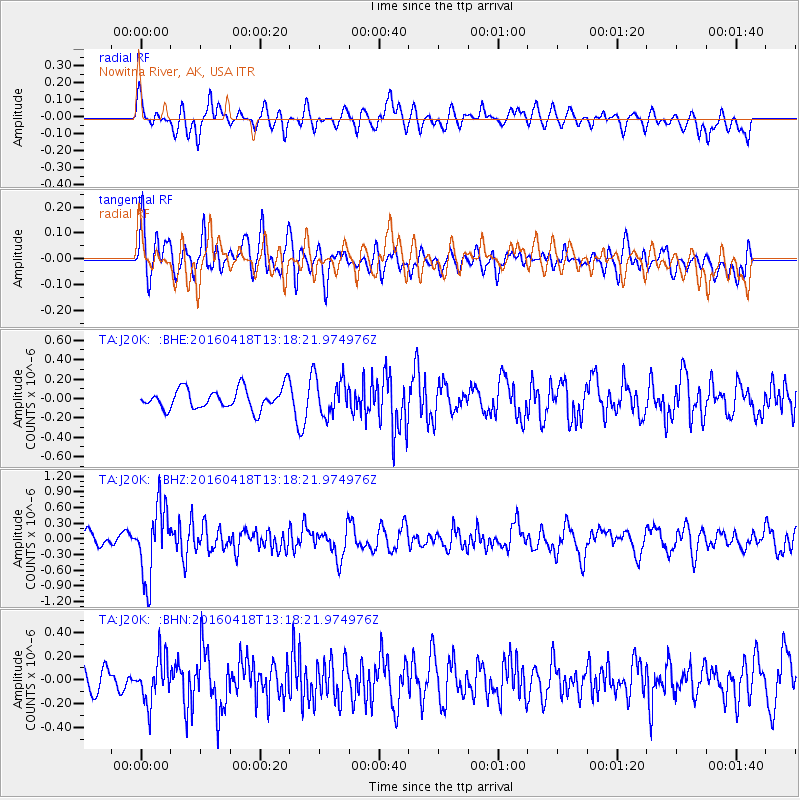
J20K Nowitna River, AK, USA - Earthquake Result Viewer
*The percent match for this event was below the threshold and hence no stack was calculated.
| Earthquake location: |
Vanuatu Islands |
| Earthquake latitude/longitude: |
-19.5/169.0 |
| Earthquake time(UTC): |
2016/04/18 (109) 13:06:11 GMT |
| Earthquake Depth: |
74 km |
| Earthquake Magnitude: |
5.9 MO |
| Earthquake Catalog/Contributor: |
NEIC PDE/NEIC ALERT |
|
| Network: |
TA USArray Transportable Network (new EarthScope stations) |
| Station: |
J20K Nowitna River, AK, USA |
| Lat/Lon: |
64.18 N/154.15 W |
| Elevation: |
314 m |
|
| Distance: |
88.1 deg |
| Az: |
15.225 deg |
| Baz: |
214.452 deg |
| Ray Param: |
$rayparam |
*The percent match for this event was below the threshold and hence was not used in the summary stack. |
|
| Radial Match: |
53.782104 % |
| Radial Bump: |
400 |
| Transverse Match: |
44.17075 % |
| Transverse Bump: |
400 |
| SOD ConfigId: |
7422571 |
| Insert Time: |
2019-04-22 09:19:02.381 +0000 |
| GWidth: |
2.5 |
| Max Bumps: |
400 |
| Tol: |
0.001 |
|
Signal To Noise
| Channel | StoN | STA | LTA |
| TA:J20K: :BHZ:20160418T13:18:21.974976Z | 5.6775923 | 6.856426E-7 | 1.2076292E-7 |
| TA:J20K: :BHN:20160418T13:18:21.974976Z | 2.215308 | 1.8784668E-7 | 8.4794834E-8 |
| TA:J20K: :BHE:20160418T13:18:21.974976Z | 1.6013542 | 1.7413629E-7 | 1.08743144E-7 |
| Arrivals |
| Ps | |
| PpPs | |
| PsPs/PpSs | |


