You are here: Home > Network List > US - United States National Seismic Network Stations List
> Station EGMT Eagleton, Montana, USA > Earthquake Result Viewer
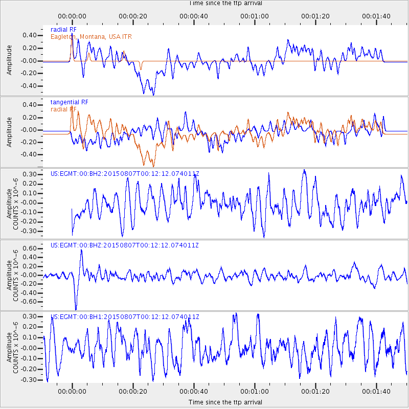
EGMT Eagleton, Montana, USA - Earthquake Result Viewer
*The percent match for this event was below the threshold and hence no stack was calculated.
| Earthquake location: |
South Of Fiji Islands |
| Earthquake latitude/longitude: |
-26.5/-178.3 |
| Earthquake time(UTC): |
2015/08/06 (218) 23:59:45 GMT |
| Earthquake Depth: |
264 km |
| Earthquake Magnitude: |
5.9 MB |
| Earthquake Catalog/Contributor: |
NEIC PDE/NEIC ALERT |
|
| Network: |
US United States National Seismic Network |
| Station: |
EGMT Eagleton, Montana, USA |
| Lat/Lon: |
48.02 N/109.75 W |
| Elevation: |
1055 m |
|
| Distance: |
96.2 deg |
| Az: |
38.939 deg |
| Baz: |
237.051 deg |
| Ray Param: |
$rayparam |
*The percent match for this event was below the threshold and hence was not used in the summary stack. |
|
| Radial Match: |
42.62189 % |
| Radial Bump: |
400 |
| Transverse Match: |
40.39949 % |
| Transverse Bump: |
400 |
| SOD ConfigId: |
1085051 |
| Insert Time: |
2015-08-21 00:21:26.346 +0000 |
| GWidth: |
2.5 |
| Max Bumps: |
400 |
| Tol: |
0.001 |
|
Signal To Noise
| Channel | StoN | STA | LTA |
| US:EGMT:00:BHZ:20150807T00:12:12.074011Z | 5.4739594 | 3.2931294E-7 | 6.015992E-8 |
| US:EGMT:00:BH1:20150807T00:12:12.074011Z | 0.6377365 | 8.8958856E-8 | 1.3949155E-7 |
| US:EGMT:00:BH2:20150807T00:12:12.074011Z | 1.0683968 | 1.4154004E-7 | 1.324789E-7 |
| Arrivals |
| Ps | |
| PpPs | |
| PsPs/PpSs | |


