You are here: Home > Network List > TA - USArray Transportable Network (new EarthScope stations) Stations List
> Station J01E Myrtle Point, OR, USA > Earthquake Result Viewer
J01E Myrtle Point, OR, USA - Earthquake Result Viewer
*The percent match for this event was below the threshold and hence no stack was calculated.
| Earthquake location: |
Near Coast Of Ecuador |
| Earthquake latitude/longitude: |
0.6/-80.1 |
| Earthquake time(UTC): |
2016/04/19 (110) 22:22:26 GMT |
| Earthquake Depth: |
15 km |
| Earthquake Magnitude: |
5.5 MB |
| Earthquake Catalog/Contributor: |
NEIC PDE/NEIC ALERT |
|
| Network: |
TA USArray Transportable Network (new EarthScope stations) |
| Station: |
J01E Myrtle Point, OR, USA |
| Lat/Lon: |
43.16 N/123.93 W |
| Elevation: |
128 m |
|
| Distance: |
57.7 deg |
| Az: |
323.14 deg |
| Baz: |
124.939 deg |
| Ray Param: |
$rayparam |
*The percent match for this event was below the threshold and hence was not used in the summary stack. |
|
| Radial Match: |
68.28809 % |
| Radial Bump: |
400 |
| Transverse Match: |
44.129753 % |
| Transverse Bump: |
400 |
| SOD ConfigId: |
7422571 |
| Insert Time: |
2019-04-22 09:36:20.576 +0000 |
| GWidth: |
2.5 |
| Max Bumps: |
400 |
| Tol: |
0.001 |
|
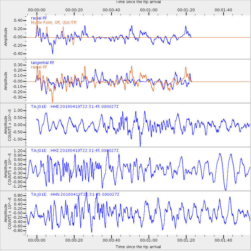
Signal To Noise
| Channel | StoN | STA | LTA |
| TA:J01E: :HHZ:20160419T22:31:45.090027Z | 1.1690191 | 3.455518E-7 | 2.9559124E-7 |
| TA:J01E: :HHN:20160419T22:31:45.090027Z | 0.8584025 | 2.6458724E-7 | 3.0823213E-7 |
| TA:J01E: :HHE:20160419T22:31:45.090027Z | 0.92109996 | 3.0823418E-7 | 3.3463706E-7 |
| Arrivals |
| Ps | |
| PpPs | |
| PsPs/PpSs | |


