You are here: Home > Network List > UW - Pacific Northwest Regional Seismic Network Stations List
> Station PASS Maple Falls, WA, USA > Earthquake Result Viewer
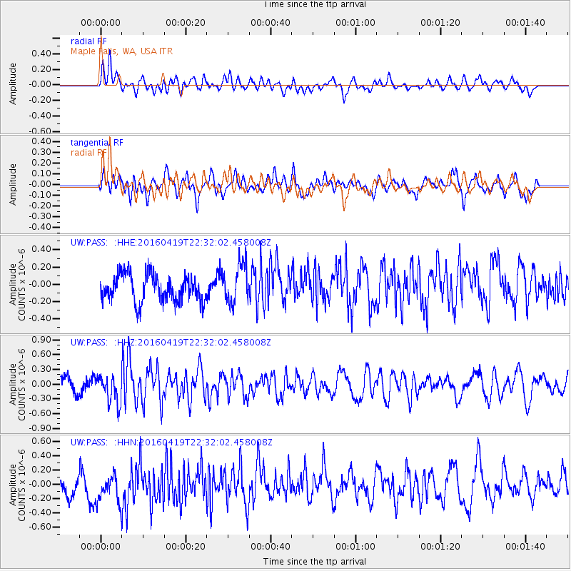
PASS Maple Falls, WA, USA - Earthquake Result Viewer
*The percent match for this event was below the threshold and hence no stack was calculated.
| Earthquake location: |
Near Coast Of Ecuador |
| Earthquake latitude/longitude: |
0.6/-80.1 |
| Earthquake time(UTC): |
2016/04/19 (110) 22:22:26 GMT |
| Earthquake Depth: |
15 km |
| Earthquake Magnitude: |
5.5 MB |
| Earthquake Catalog/Contributor: |
NEIC PDE/NEIC ALERT |
|
| Network: |
UW Pacific Northwest Regional Seismic Network |
| Station: |
PASS Maple Falls, WA, USA |
| Lat/Lon: |
49.00 N/122.09 W |
| Elevation: |
174 m |
|
| Distance: |
60.2 deg |
| Az: |
329.472 deg |
| Baz: |
129.533 deg |
| Ray Param: |
$rayparam |
*The percent match for this event was below the threshold and hence was not used in the summary stack. |
|
| Radial Match: |
57.335606 % |
| Radial Bump: |
400 |
| Transverse Match: |
65.823235 % |
| Transverse Bump: |
400 |
| SOD ConfigId: |
7422571 |
| Insert Time: |
2019-04-22 09:37:20.908 +0000 |
| GWidth: |
2.5 |
| Max Bumps: |
400 |
| Tol: |
0.001 |
|
Signal To Noise
| Channel | StoN | STA | LTA |
| UW:PASS: :HHZ:20160419T22:32:02.458008Z | 1.8618138 | 2.871181E-7 | 1.5421419E-7 |
| UW:PASS: :HHN:20160419T22:32:02.458008Z | 1.324025 | 2.1664762E-7 | 1.6362804E-7 |
| UW:PASS: :HHE:20160419T22:32:02.458008Z | 1.4796846 | 2.3091717E-7 | 1.5605836E-7 |
| Arrivals |
| Ps | |
| PpPs | |
| PsPs/PpSs | |


