You are here: Home > Network List > CI - Caltech Regional Seismic Network Stations List
> Station SMM Simmler, CA, USA > Earthquake Result Viewer
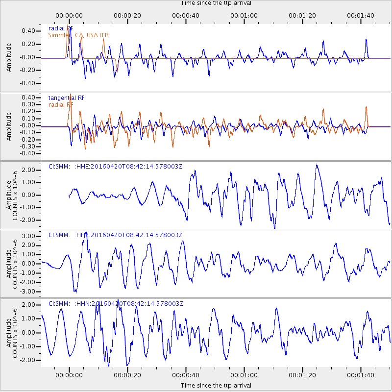
SMM Simmler, CA, USA - Earthquake Result Viewer
*The percent match for this event was below the threshold and hence no stack was calculated.
| Earthquake location: |
Near Coast Of Ecuador |
| Earthquake latitude/longitude: |
0.6/-80.3 |
| Earthquake time(UTC): |
2016/04/20 (111) 08:33:48 GMT |
| Earthquake Depth: |
16 km |
| Earthquake Magnitude: |
6.1 MO |
| Earthquake Catalog/Contributor: |
NEIC PDE/NEIC ALERT |
|
| Network: |
CI Caltech Regional Seismic Network |
| Station: |
SMM Simmler, CA, USA |
| Lat/Lon: |
35.31 N/120.00 W |
| Elevation: |
599 m |
|
| Distance: |
50.6 deg |
| Az: |
317.416 deg |
| Baz: |
124.171 deg |
| Ray Param: |
$rayparam |
*The percent match for this event was below the threshold and hence was not used in the summary stack. |
|
| Radial Match: |
74.2101 % |
| Radial Bump: |
400 |
| Transverse Match: |
28.759104 % |
| Transverse Bump: |
400 |
| SOD ConfigId: |
7422571 |
| Insert Time: |
2019-04-22 09:43:19.362 +0000 |
| GWidth: |
2.5 |
| Max Bumps: |
400 |
| Tol: |
0.001 |
|
Signal To Noise
| Channel | StoN | STA | LTA |
| CI:SMM: :HHZ:20160420T08:42:14.578003Z | 3.7535276 | 1.714279E-6 | 4.5671146E-7 |
| CI:SMM: :HHN:20160420T08:42:14.578003Z | 1.5244548 | 1.1657731E-6 | 7.6471474E-7 |
| CI:SMM: :HHE:20160420T08:42:14.578003Z | 1.7371974 | 5.3627275E-7 | 3.0869992E-7 |
| Arrivals |
| Ps | |
| PpPs | |
| PsPs/PpSs | |


