You are here: Home > Network List > CI - Caltech Regional Seismic Network Stations List
> Station SWS Sam W. Stewart, Westmorland, CA, USA > Earthquake Result Viewer
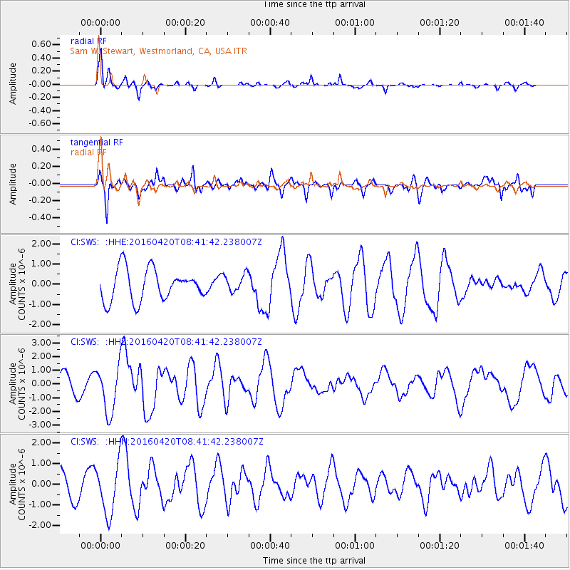
SWS Sam W. Stewart, Westmorland, CA, USA - Earthquake Result Viewer
*The percent match for this event was below the threshold and hence no stack was calculated.
| Earthquake location: |
Near Coast Of Ecuador |
| Earthquake latitude/longitude: |
0.6/-80.3 |
| Earthquake time(UTC): |
2016/04/20 (111) 08:33:48 GMT |
| Earthquake Depth: |
16 km |
| Earthquake Magnitude: |
6.1 MO |
| Earthquake Catalog/Contributor: |
NEIC PDE/NEIC ALERT |
|
| Network: |
CI Caltech Regional Seismic Network |
| Station: |
SWS Sam W. Stewart, Westmorland, CA, USA |
| Lat/Lon: |
32.94 N/115.80 W |
| Elevation: |
140 m |
|
| Distance: |
46.4 deg |
| Az: |
317.534 deg |
| Baz: |
126.596 deg |
| Ray Param: |
$rayparam |
*The percent match for this event was below the threshold and hence was not used in the summary stack. |
|
| Radial Match: |
78.16585 % |
| Radial Bump: |
291 |
| Transverse Match: |
73.93981 % |
| Transverse Bump: |
365 |
| SOD ConfigId: |
7422571 |
| Insert Time: |
2019-04-22 09:43:21.771 +0000 |
| GWidth: |
2.5 |
| Max Bumps: |
400 |
| Tol: |
0.001 |
|
Signal To Noise
| Channel | StoN | STA | LTA |
| CI:SWS: :HHZ:20160420T08:41:42.238007Z | 1.9637959 | 1.7711466E-6 | 9.018995E-7 |
| CI:SWS: :HHN:20160420T08:41:42.238007Z | 1.8433808 | 1.2690781E-6 | 6.884514E-7 |
| CI:SWS: :HHE:20160420T08:41:42.238007Z | 0.5767824 | 4.4788837E-7 | 7.7652913E-7 |
| Arrivals |
| Ps | |
| PpPs | |
| PsPs/PpSs | |


