You are here: Home > Network List > G - GEOSCOPE Stations List
> Station MPG Montagne des Peres, French Guyana > Earthquake Result Viewer
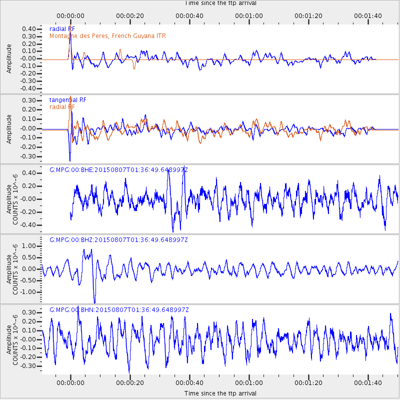
MPG Montagne des Peres, French Guyana - Earthquake Result Viewer
*The percent match for this event was below the threshold and hence no stack was calculated.
| Earthquake location: |
Lake Tanganyika Region |
| Earthquake latitude/longitude: |
-2.2/28.9 |
| Earthquake time(UTC): |
2015/08/07 (219) 01:25:02 GMT |
| Earthquake Depth: |
10 km |
| Earthquake Magnitude: |
5.6 MB |
| Earthquake Catalog/Contributor: |
NEIC PDE/NEIC COMCAT |
|
| Network: |
G GEOSCOPE |
| Station: |
MPG Montagne des Peres, French Guyana |
| Lat/Lon: |
5.11 N/52.64 W |
| Elevation: |
147 m |
|
| Distance: |
81.8 deg |
| Az: |
275.445 deg |
| Baz: |
92.915 deg |
| Ray Param: |
$rayparam |
*The percent match for this event was below the threshold and hence was not used in the summary stack. |
|
| Radial Match: |
67.980705 % |
| Radial Bump: |
400 |
| Transverse Match: |
70.553795 % |
| Transverse Bump: |
400 |
| SOD ConfigId: |
1085051 |
| Insert Time: |
2015-08-21 01:28:30.428 +0000 |
| GWidth: |
2.5 |
| Max Bumps: |
400 |
| Tol: |
0.001 |
|
Signal To Noise
| Channel | StoN | STA | LTA |
| G:MPG:00:BHZ:20150807T01:36:49.648997Z | 3.1204464 | 4.234343E-7 | 1.3569671E-7 |
| G:MPG:00:BHN:20150807T01:36:49.648997Z | 1.6921669 | 1.6369476E-7 | 9.673677E-8 |
| G:MPG:00:BHE:20150807T01:36:49.648997Z | 1.8736045 | 2.2530575E-7 | 1.2025257E-7 |
| Arrivals |
| Ps | |
| PpPs | |
| PsPs/PpSs | |


