You are here: Home > Network List > UW - Pacific Northwest Regional Seismic Network Stations List
> Station LCCR Mulino, OR, USA > Earthquake Result Viewer
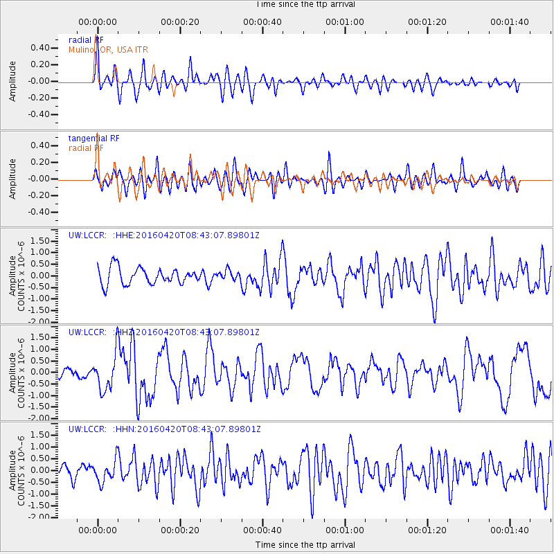
LCCR Mulino, OR, USA - Earthquake Result Viewer
*The percent match for this event was below the threshold and hence no stack was calculated.
| Earthquake location: |
Near Coast Of Ecuador |
| Earthquake latitude/longitude: |
0.6/-80.3 |
| Earthquake time(UTC): |
2016/04/20 (111) 08:33:48 GMT |
| Earthquake Depth: |
16 km |
| Earthquake Magnitude: |
6.1 MO |
| Earthquake Catalog/Contributor: |
NEIC PDE/NEIC ALERT |
|
| Network: |
UW Pacific Northwest Regional Seismic Network |
| Station: |
LCCR Mulino, OR, USA |
| Lat/Lon: |
45.21 N/122.48 W |
| Elevation: |
273 m |
|
| Distance: |
57.9 deg |
| Az: |
325.905 deg |
| Baz: |
127.542 deg |
| Ray Param: |
$rayparam |
*The percent match for this event was below the threshold and hence was not used in the summary stack. |
|
| Radial Match: |
71.02434 % |
| Radial Bump: |
400 |
| Transverse Match: |
71.541855 % |
| Transverse Bump: |
400 |
| SOD ConfigId: |
7422571 |
| Insert Time: |
2019-04-22 09:51:23.871 +0000 |
| GWidth: |
2.5 |
| Max Bumps: |
400 |
| Tol: |
0.001 |
|
Signal To Noise
| Channel | StoN | STA | LTA |
| UW:LCCR: :HHZ:20160420T08:43:07.89801Z | 4.6394577 | 8.1188546E-7 | 1.7499578E-7 |
| UW:LCCR: :HHN:20160420T08:43:07.89801Z | 1.8968902 | 4.6947468E-7 | 2.4749704E-7 |
| UW:LCCR: :HHE:20160420T08:43:07.89801Z | 0.76466316 | 2.6525464E-7 | 3.4689083E-7 |
| Arrivals |
| Ps | |
| PpPs | |
| PsPs/PpSs | |


