You are here: Home > Network List > CN - Canadian National Seismograph Network Stations List
> Station INK INUVIK, NT > Earthquake Result Viewer
INK INUVIK, NT - Earthquake Result Viewer
*The percent match for this event was below the threshold and hence no stack was calculated.
| Earthquake location: |
North Atlantic Ocean |
| Earthquake latitude/longitude: |
13.2/-55.9 |
| Earthquake time(UTC): |
2016/04/20 (111) 10:51:39 GMT |
| Earthquake Depth: |
10 km |
| Earthquake Magnitude: |
5.8 MB |
| Earthquake Catalog/Contributor: |
NEIC PDE/NEIC COMCAT |
|
| Network: |
CN Canadian National Seismograph Network |
| Station: |
INK INUVIK, NT |
| Lat/Lon: |
68.31 N/133.53 W |
| Elevation: |
44 m |
|
| Distance: |
73.2 deg |
| Az: |
337.714 deg |
| Baz: |
96.583 deg |
| Ray Param: |
$rayparam |
*The percent match for this event was below the threshold and hence was not used in the summary stack. |
|
| Radial Match: |
61.777103 % |
| Radial Bump: |
400 |
| Transverse Match: |
61.011395 % |
| Transverse Bump: |
400 |
| SOD ConfigId: |
7422571 |
| Insert Time: |
2019-04-22 10:05:25.089 +0000 |
| GWidth: |
2.5 |
| Max Bumps: |
400 |
| Tol: |
0.001 |
|
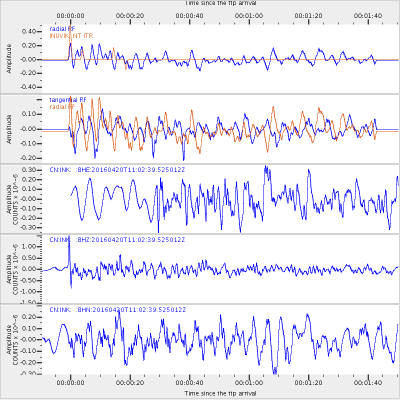
Signal To Noise
| Channel | StoN | STA | LTA |
| CN:INK: :BHZ:20160420T11:02:39.525012Z | 4.2265515 | 4.3017712E-7 | 1.017797E-7 |
| CN:INK: :BHN:20160420T11:02:39.525012Z | 0.72841066 | 5.955737E-8 | 8.176345E-8 |
| CN:INK: :BHE:20160420T11:02:39.525012Z | 1.1268203 | 1.3253376E-7 | 1.1761747E-7 |
| Arrivals |
| Ps | |
| PpPs | |
| PsPs/PpSs | |


