WMOK Wichita Mountains, Oklahoma, USA - Earthquake Result Viewer
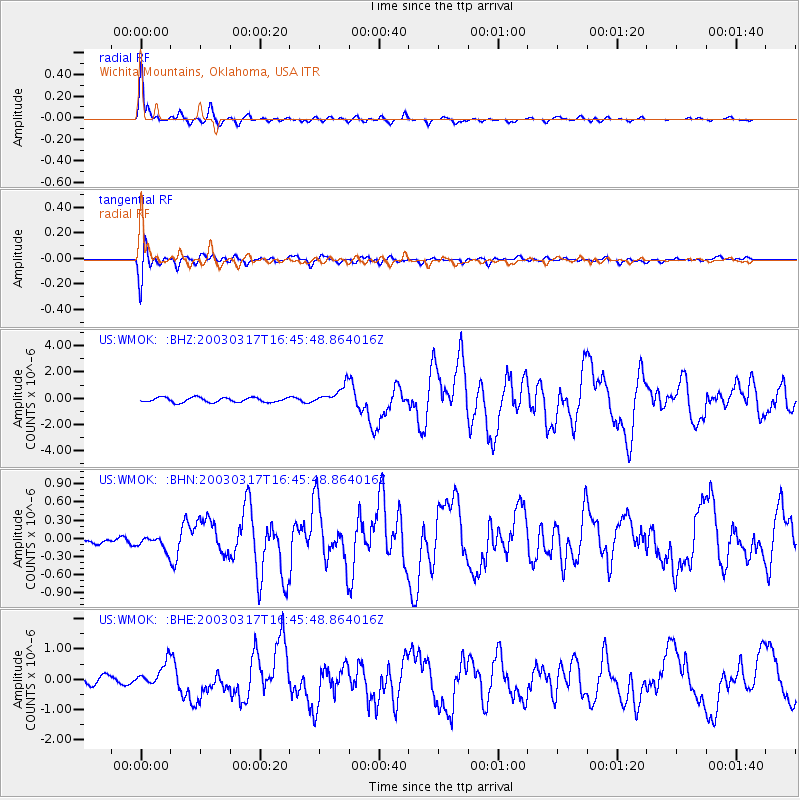
Earthquake location: Rat Islands, Aleutian Islands
Earthquake latitude/longitude: 51.3/178.0
Earthquake time(UTC): 2003/03/17 (076) 16:36:17 GMT
Earthquake Depth: 33 km
Earthquake Magnitude: 5.9 MB, 6.7 MS, 7.0 MW, 7.0 MW
Earthquake Catalog/Contributor: WHDF/NEIC
Network: US United States National Seismic Network
Station: WMOK Wichita Mountains, Oklahoma, USA
Lat/Lon: 34.74 N/98.78 W
Elevation: 486 m
Distance: 59.9 deg
Az: 71.043 deg
Baz: 313.83 deg
Ray Param: 0.061860353
Estimated Moho Depth: 69.0 km
Estimated Crust Vp/Vs: 2.04
Assumed Crust Vp: 6.315 km/s
Estimated Crust Vs: 3.099 km/s
Estimated Crust Poisson's Ratio: 0.34
Radial Match: 93.30115 %
Radial Bump: 400
Transverse Match: 84.994446 %
Transverse Bump: 400
SOD ConfigId: 110177
Insert Time: 2010-03-05 02:00:11.394 +0000
GWidth: 2.5
Max Bumps: 400
Tol: 0.001

Signal To Noise

ChannelStoNSTALTA
US:WMOK: :BHN:20030317T16:45:48.864016Z0.999455451.10697535E-71.10757846E-7
US:WMOK: :BHE:20030317T16:45:48.864016Z2.67043544.2006627E-71.5730254E-7
US:WMOK: :BHZ:20030317T16:45:48.864016Z4.00801377.2116126E-71.7992984E-7
Arrivals
Ps12 SECOND
PpPs32 SECOND
PsPs/PpSs44 SECOND