You are here: Home > Network List > US - United States National Seismic Network Stations List
> Station HAWA Hanford, Washington, USA > Earthquake Result Viewer
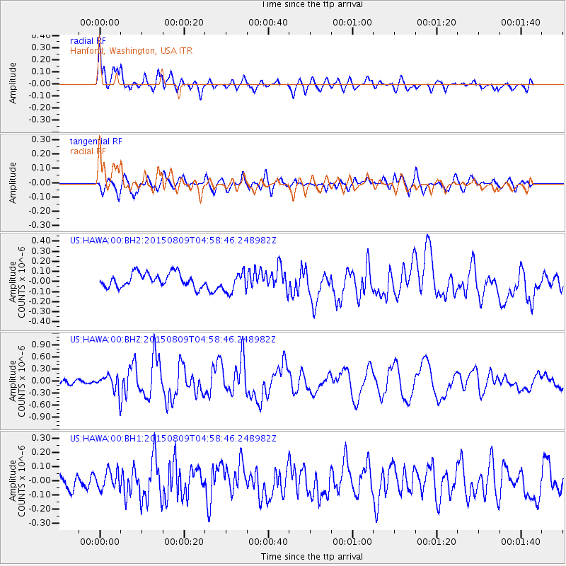
HAWA Hanford, Washington, USA - Earthquake Result Viewer
*The percent match for this event was below the threshold and hence no stack was calculated.
| Earthquake location: |
Kermadec Islands Region |
| Earthquake latitude/longitude: |
-27.4/-176.1 |
| Earthquake time(UTC): |
2015/08/09 (221) 04:46:20 GMT |
| Earthquake Depth: |
10 km |
| Earthquake Magnitude: |
5.9 MWP |
| Earthquake Catalog/Contributor: |
NEIC PDE/NEIC COMCAT |
|
| Network: |
US United States National Seismic Network |
| Station: |
HAWA Hanford, Washington, USA |
| Lat/Lon: |
46.39 N/119.53 W |
| Elevation: |
364 m |
|
| Distance: |
89.5 deg |
| Az: |
35.284 deg |
| Baz: |
227.895 deg |
| Ray Param: |
$rayparam |
*The percent match for this event was below the threshold and hence was not used in the summary stack. |
|
| Radial Match: |
74.900345 % |
| Radial Bump: |
400 |
| Transverse Match: |
54.16479 % |
| Transverse Bump: |
400 |
| SOD ConfigId: |
1085051 |
| Insert Time: |
2015-08-23 05:08:26.473 +0000 |
| GWidth: |
2.5 |
| Max Bumps: |
400 |
| Tol: |
0.001 |
|
Signal To Noise
| Channel | StoN | STA | LTA |
| US:HAWA:00:BHZ:20150809T04:58:46.248982Z | 3.432112 | 2.2244038E-7 | 6.4811516E-8 |
| US:HAWA:00:BH1:20150809T04:58:46.248982Z | 1.1556762 | 6.620423E-8 | 5.7286137E-8 |
| US:HAWA:00:BH2:20150809T04:58:46.248982Z | 1.4840301 | 1.0134221E-7 | 6.8288514E-8 |
| Arrivals |
| Ps | |
| PpPs | |
| PsPs/PpSs | |


