WMOK Wichita Mountains, Oklahoma, USA - Earthquake Result Viewer
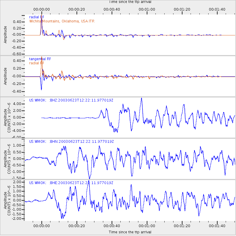
Earthquake location: Rat Islands, Aleutian Islands
Earthquake latitude/longitude: 51.4/176.8
Earthquake time(UTC): 2003/06/23 (174) 12:12:34 GMT
Earthquake Depth: 20 km
Earthquake Magnitude: 6.3 MB, 7.0 MS, 6.9 MW, 6.8 MW
Earthquake Catalog/Contributor: WHDF/NEIC
Network: US United States National Seismic Network
Station: WMOK Wichita Mountains, Oklahoma, USA
Lat/Lon: 34.74 N/98.78 W
Elevation: 486 m
Distance: 60.5 deg
Az: 70.345 deg
Baz: 314.297 deg
Ray Param: 0.0614662
Estimated Moho Depth: 25.25 km
Estimated Crust Vp/Vs: 2.10
Assumed Crust Vp: 6.315 km/s
Estimated Crust Vs: 3.011 km/s
Estimated Crust Poisson's Ratio: 0.35
Radial Match: 97.18409 %
Radial Bump: 384
Transverse Match: 92.19685 %
Transverse Bump: 400
SOD ConfigId: 110177
Insert Time: 2010-03-05 02:00:28.165 +0000
GWidth: 2.5
Max Bumps: 400
Tol: 0.001

Signal To Noise

ChannelStoNSTALTA
US:WMOK: :BHN:20030623T12:22:11.977019Z2.29622671.7229952E-77.503594E-8
US:WMOK: :BHE:20030623T12:22:11.977019Z7.7283643.910572E-75.0600253E-8
US:WMOK: :BHZ:20030623T12:22:11.977019Z17.8842099.357632E-75.232343E-8
Arrivals
Ps4.6 SECOND
PpPs12 SECOND
PsPs/PpSs16 SECOND