You are here: Home > Network List > TA - USArray Transportable Network (new EarthScope stations) Stations List
> Station M31M Drury Creek, Yukon, CA > Earthquake Result Viewer
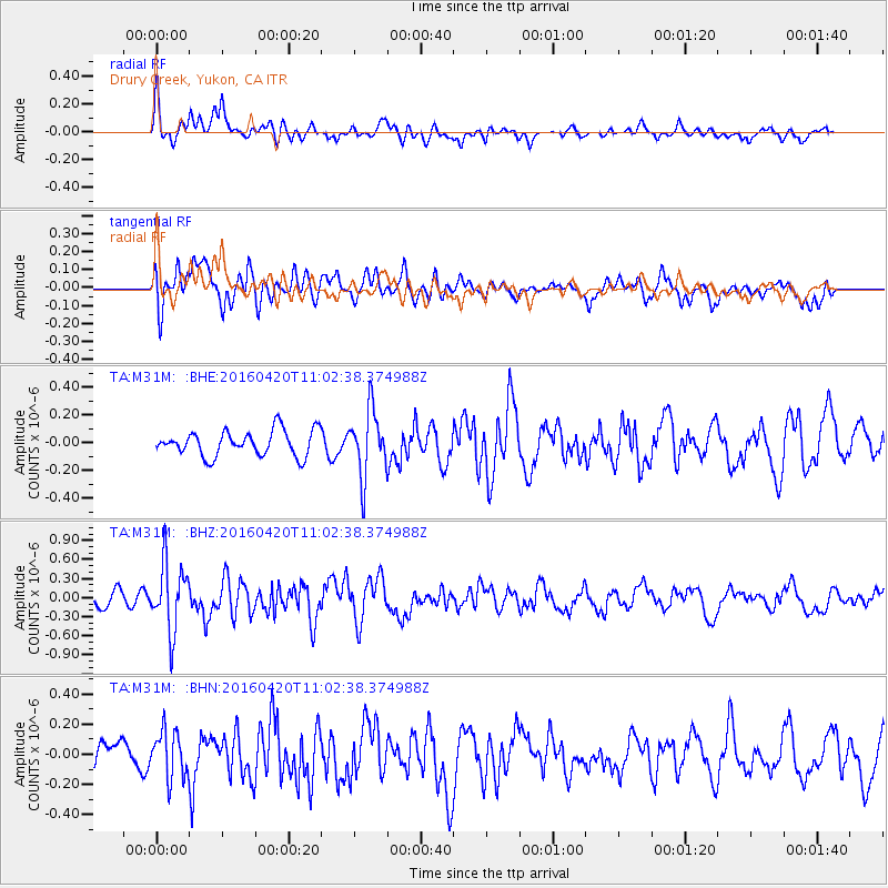
M31M Drury Creek, Yukon, CA - Earthquake Result Viewer
*The percent match for this event was below the threshold and hence no stack was calculated.
| Earthquake location: |
North Atlantic Ocean |
| Earthquake latitude/longitude: |
13.2/-55.9 |
| Earthquake time(UTC): |
2016/04/20 (111) 10:51:39 GMT |
| Earthquake Depth: |
10 km |
| Earthquake Magnitude: |
5.8 MB |
| Earthquake Catalog/Contributor: |
NEIC PDE/NEIC COMCAT |
|
| Network: |
TA USArray Transportable Network (new EarthScope stations) |
| Station: |
M31M Drury Creek, Yukon, CA |
| Lat/Lon: |
62.20 N/134.39 W |
| Elevation: |
639 m |
|
| Distance: |
73.0 deg |
| Az: |
331.299 deg |
| Baz: |
93.935 deg |
| Ray Param: |
$rayparam |
*The percent match for this event was below the threshold and hence was not used in the summary stack. |
|
| Radial Match: |
51.22757 % |
| Radial Bump: |
400 |
| Transverse Match: |
72.842026 % |
| Transverse Bump: |
400 |
| SOD ConfigId: |
7422571 |
| Insert Time: |
2019-04-22 10:11:10.192 +0000 |
| GWidth: |
2.5 |
| Max Bumps: |
400 |
| Tol: |
0.001 |
|
Signal To Noise
| Channel | StoN | STA | LTA |
| TA:M31M: :BHZ:20160420T11:02:38.374988Z | 5.111218 | 5.300677E-7 | 1.03706725E-7 |
| TA:M31M: :BHN:20160420T11:02:38.374988Z | 1.8750802 | 1.55132E-7 | 8.273352E-8 |
| TA:M31M: :BHE:20160420T11:02:38.374988Z | 2.5942633 | 2.3725514E-7 | 9.145376E-8 |
| Arrivals |
| Ps | |
| PpPs | |
| PsPs/PpSs | |


