You are here: Home > Network List > TA - USArray Transportable Network (new EarthScope stations) Stations List
> Station MDND Maddock, ND, USA > Earthquake Result Viewer
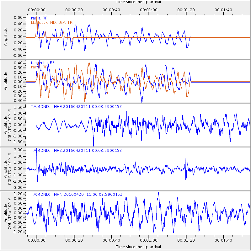
MDND Maddock, ND, USA - Earthquake Result Viewer
*The percent match for this event was below the threshold and hence no stack was calculated.
| Earthquake location: |
North Atlantic Ocean |
| Earthquake latitude/longitude: |
13.2/-55.9 |
| Earthquake time(UTC): |
2016/04/20 (111) 10:51:39 GMT |
| Earthquake Depth: |
10 km |
| Earthquake Magnitude: |
5.8 MB |
| Earthquake Catalog/Contributor: |
NEIC PDE/NEIC COMCAT |
|
| Network: |
TA USArray Transportable Network (new EarthScope stations) |
| Station: |
MDND Maddock, ND, USA |
| Lat/Lon: |
47.85 N/99.60 W |
| Elevation: |
479 m |
|
| Distance: |
50.0 deg |
| Az: |
322.639 deg |
| Baz: |
118.669 deg |
| Ray Param: |
$rayparam |
*The percent match for this event was below the threshold and hence was not used in the summary stack. |
|
| Radial Match: |
56.013214 % |
| Radial Bump: |
400 |
| Transverse Match: |
57.42385 % |
| Transverse Bump: |
400 |
| SOD ConfigId: |
7422571 |
| Insert Time: |
2019-04-22 10:11:12.270 +0000 |
| GWidth: |
2.5 |
| Max Bumps: |
400 |
| Tol: |
0.001 |
|
Signal To Noise
| Channel | StoN | STA | LTA |
| TA:MDND: :HHZ:20160420T11:00:03.590015Z | 9.168526 | 9.140724E-7 | 9.969678E-8 |
| TA:MDND: :HHN:20160420T11:00:03.590015Z | 1.6341496 | 4.6052688E-7 | 2.818144E-7 |
| TA:MDND: :HHE:20160420T11:00:03.590015Z | 2.0838163 | 5.4614117E-7 | 2.62087E-7 |
| Arrivals |
| Ps | |
| PpPs | |
| PsPs/PpSs | |


