WMOK Wichita Mountains, Oklahoma, USA - Earthquake Result Viewer
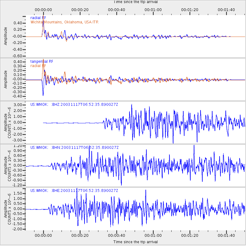
Earthquake location: Rat Islands, Aleutian Islands
Earthquake latitude/longitude: 51.1/178.6
Earthquake time(UTC): 2003/11/17 (321) 06:43:06 GMT
Earthquake Depth: 33 km
Earthquake Magnitude: 6.2 MB, 7.2 MS, 7.8 MW, 7.7 MW
Earthquake Catalog/Contributor: WHDF/NEIC
Network: US United States National Seismic Network
Station: WMOK Wichita Mountains, Oklahoma, USA
Lat/Lon: 34.74 N/98.78 W
Elevation: 486 m
Distance: 59.5 deg
Az: 71.416 deg
Baz: 313.534 deg
Ray Param: 0.06209502
Estimated Moho Depth: 39.25 km
Estimated Crust Vp/Vs: 1.96
Assumed Crust Vp: 6.315 km/s
Estimated Crust Vs: 3.23 km/s
Estimated Crust Poisson's Ratio: 0.32
Radial Match: 94.981735 %
Radial Bump: 400
Transverse Match: 95.6255 %
Transverse Bump: 400
SOD ConfigId: 110177
Insert Time: 2010-03-05 02:00:41.518 +0000
GWidth: 2.5
Max Bumps: 400
Tol: 0.001

Signal To Noise

ChannelStoNSTALTA
US:WMOK: :BHN:20031117T06:52:35.890027Z2.24708063.9069402E-81.738674E-8
US:WMOK: :BHE:20031117T06:52:35.890027Z11.33801651.7615265E-71.5536461E-8
US:WMOK: :BHZ:20031117T06:52:35.890027Z18.2754343.2666213E-71.7874383E-8
Arrivals
Ps6.2 SECOND
PpPs18 SECOND
PsPs/PpSs24 SECOND