You are here: Home > Network List > UW - Pacific Northwest Regional Seismic Network Stations List
> Station LCCR Mulino, OR, USA > Earthquake Result Viewer
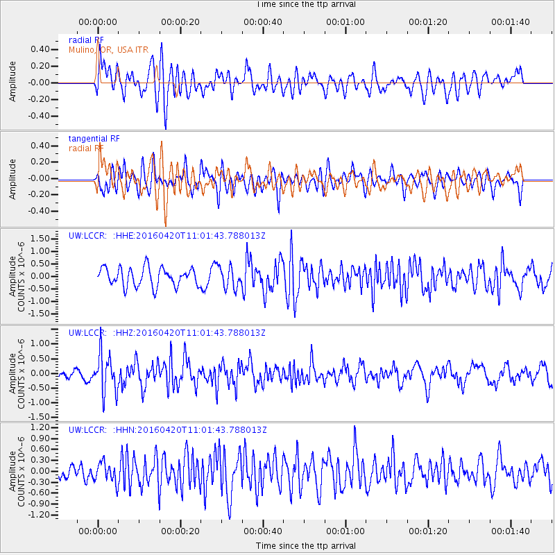
LCCR Mulino, OR, USA - Earthquake Result Viewer
*The percent match for this event was below the threshold and hence no stack was calculated.
| Earthquake location: |
North Atlantic Ocean |
| Earthquake latitude/longitude: |
13.2/-55.9 |
| Earthquake time(UTC): |
2016/04/20 (111) 10:51:39 GMT |
| Earthquake Depth: |
10 km |
| Earthquake Magnitude: |
5.8 MB |
| Earthquake Catalog/Contributor: |
NEIC PDE/NEIC COMCAT |
|
| Network: |
UW Pacific Northwest Regional Seismic Network |
| Station: |
LCCR Mulino, OR, USA |
| Lat/Lon: |
45.21 N/122.48 W |
| Elevation: |
273 m |
|
| Distance: |
64.2 deg |
| Az: |
313.939 deg |
| Baz: |
97.249 deg |
| Ray Param: |
$rayparam |
*The percent match for this event was below the threshold and hence was not used in the summary stack. |
|
| Radial Match: |
56.784172 % |
| Radial Bump: |
400 |
| Transverse Match: |
64.58666 % |
| Transverse Bump: |
400 |
| SOD ConfigId: |
7422571 |
| Insert Time: |
2019-04-22 10:12:02.265 +0000 |
| GWidth: |
2.5 |
| Max Bumps: |
400 |
| Tol: |
0.001 |
|
Signal To Noise
| Channel | StoN | STA | LTA |
| UW:LCCR: :HHZ:20160420T11:01:43.788013Z | 2.4834101 | 6.666535E-7 | 2.6844273E-7 |
| UW:LCCR: :HHN:20160420T11:01:43.788013Z | 0.91302943 | 2.8060626E-7 | 3.0733537E-7 |
| UW:LCCR: :HHE:20160420T11:01:43.788013Z | 1.1493304 | 4.2100982E-7 | 3.663088E-7 |
| Arrivals |
| Ps | |
| PpPs | |
| PsPs/PpSs | |


