You are here: Home > Network List > UW - Pacific Northwest Regional Seismic Network Stations List
> Station UMAT Pilot Rock, OR, USA > Earthquake Result Viewer
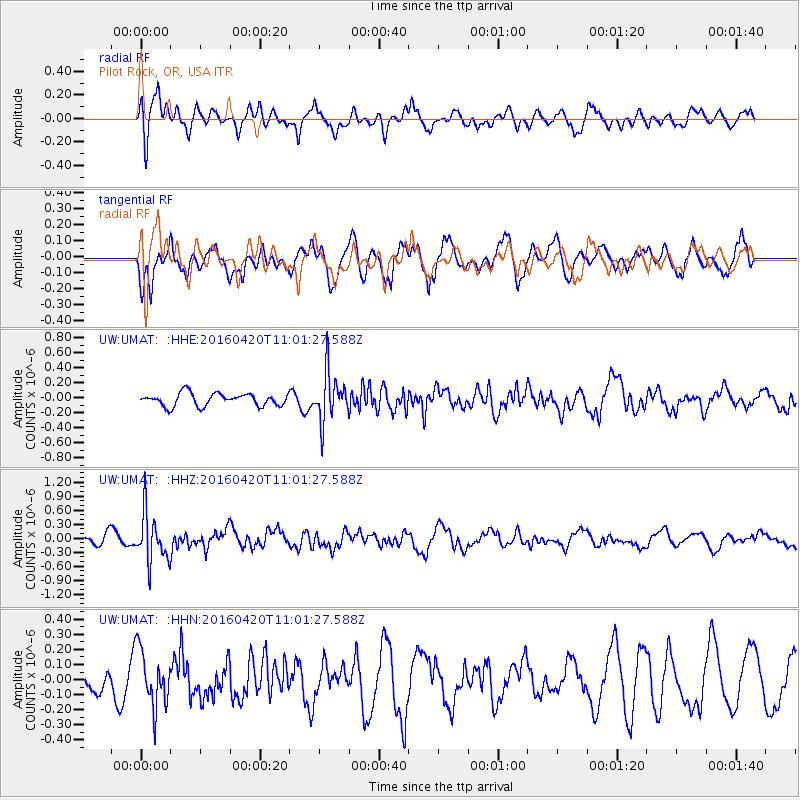
UMAT Pilot Rock, OR, USA - Earthquake Result Viewer
*The percent match for this event was below the threshold and hence no stack was calculated.
| Earthquake location: |
North Atlantic Ocean |
| Earthquake latitude/longitude: |
13.2/-55.9 |
| Earthquake time(UTC): |
2016/04/20 (111) 10:51:39 GMT |
| Earthquake Depth: |
10 km |
| Earthquake Magnitude: |
5.8 MB |
| Earthquake Catalog/Contributor: |
NEIC PDE/NEIC COMCAT |
|
| Network: |
UW Pacific Northwest Regional Seismic Network |
| Station: |
UMAT Pilot Rock, OR, USA |
| Lat/Lon: |
45.29 N/118.96 W |
| Elevation: |
1318 m |
|
| Distance: |
61.8 deg |
| Az: |
314.45 deg |
| Baz: |
99.972 deg |
| Ray Param: |
$rayparam |
*The percent match for this event was below the threshold and hence was not used in the summary stack. |
|
| Radial Match: |
59.14059 % |
| Radial Bump: |
400 |
| Transverse Match: |
62.277332 % |
| Transverse Bump: |
400 |
| SOD ConfigId: |
7422571 |
| Insert Time: |
2019-04-22 10:12:13.906 +0000 |
| GWidth: |
2.5 |
| Max Bumps: |
400 |
| Tol: |
0.001 |
|
Signal To Noise
| Channel | StoN | STA | LTA |
| UW:UMAT: :HHZ:20160420T11:01:27.588Z | 4.5481133 | 5.216704E-7 | 1.147004E-7 |
| UW:UMAT: :HHN:20160420T11:01:27.588Z | 1.4965703 | 1.8470874E-7 | 1.2342136E-7 |
| UW:UMAT: :HHE:20160420T11:01:27.588Z | 3.8056746 | 3.209212E-7 | 8.432702E-8 |
| Arrivals |
| Ps | |
| PpPs | |
| PsPs/PpSs | |


