You are here: Home > Network List > CI - Caltech Regional Seismic Network Stations List
> Station BFS Mt Baldy Forest Station > Earthquake Result Viewer
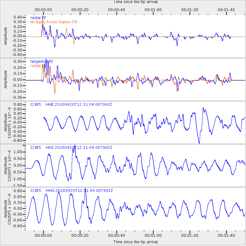
BFS Mt Baldy Forest Station - Earthquake Result Viewer
*The percent match for this event was below the threshold and hence no stack was calculated.
| Earthquake location: |
Near East Coast Of Honshu, Japan |
| Earthquake latitude/longitude: |
37.8/141.6 |
| Earthquake time(UTC): |
2016/04/20 (111) 12:19:45 GMT |
| Earthquake Depth: |
41 km |
| Earthquake Magnitude: |
5.8 MB |
| Earthquake Catalog/Contributor: |
NEIC PDE/NEIC ALERT |
|
| Network: |
CI Caltech Regional Seismic Network |
| Station: |
BFS Mt Baldy Forest Station |
| Lat/Lon: |
34.24 N/117.66 W |
| Elevation: |
1312 m |
|
| Distance: |
77.3 deg |
| Az: |
56.539 deg |
| Baz: |
307.1 deg |
| Ray Param: |
$rayparam |
*The percent match for this event was below the threshold and hence was not used in the summary stack. |
|
| Radial Match: |
66.82087 % |
| Radial Bump: |
400 |
| Transverse Match: |
91.32113 % |
| Transverse Bump: |
400 |
| SOD ConfigId: |
7422571 |
| Insert Time: |
2019-04-22 10:16:31.076 +0000 |
| GWidth: |
2.5 |
| Max Bumps: |
400 |
| Tol: |
0.001 |
|
Signal To Noise
| Channel | StoN | STA | LTA |
| CI:BFS: :HHZ:20160420T12:31:04.067993Z | 2.2891188 | 5.897175E-7 | 2.5761767E-7 |
| CI:BFS: :HHN:20160420T12:31:04.067993Z | 1.6954976 | 5.2791785E-7 | 3.1136454E-7 |
| CI:BFS: :HHE:20160420T12:31:04.067993Z | 1.1047931 | 2.3489557E-7 | 2.12615E-7 |
| Arrivals |
| Ps | |
| PpPs | |
| PsPs/PpSs | |


