You are here: Home > Network List > CN - Canadian National Seismograph Network Stations List
> Station FRB IQALUIT, N.W.T. > Earthquake Result Viewer
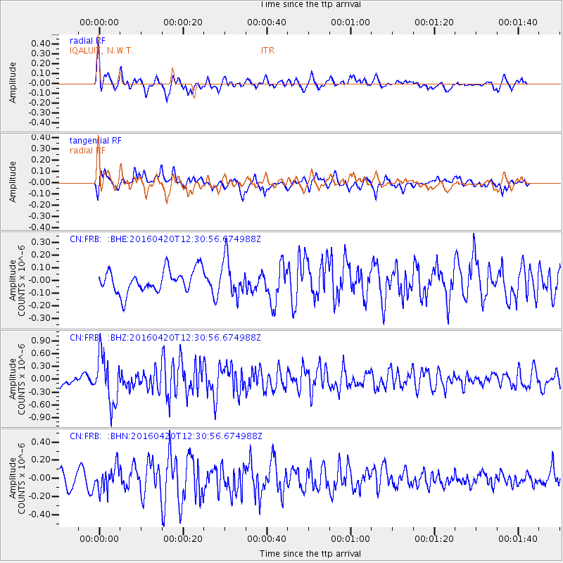
FRB IQALUIT, N.W.T. - Earthquake Result Viewer
*The percent match for this event was below the threshold and hence no stack was calculated.
| Earthquake location: |
Near East Coast Of Honshu, Japan |
| Earthquake latitude/longitude: |
37.8/141.6 |
| Earthquake time(UTC): |
2016/04/20 (111) 12:19:45 GMT |
| Earthquake Depth: |
41 km |
| Earthquake Magnitude: |
5.8 MB |
| Earthquake Catalog/Contributor: |
NEIC PDE/NEIC ALERT |
|
| Network: |
CN Canadian National Seismograph Network |
| Station: |
FRB IQALUIT, N.W.T. |
| Lat/Lon: |
63.75 N/68.55 W |
| Elevation: |
18 m |
|
| Distance: |
76.0 deg |
| Az: |
13.306 deg |
| Baz: |
335.804 deg |
| Ray Param: |
$rayparam |
*The percent match for this event was below the threshold and hence was not used in the summary stack. |
|
| Radial Match: |
72.98412 % |
| Radial Bump: |
400 |
| Transverse Match: |
65.68767 % |
| Transverse Bump: |
400 |
| SOD ConfigId: |
7422571 |
| Insert Time: |
2019-04-22 10:17:07.565 +0000 |
| GWidth: |
2.5 |
| Max Bumps: |
400 |
| Tol: |
0.001 |
|
Signal To Noise
| Channel | StoN | STA | LTA |
| CN:FRB: :BHZ:20160420T12:30:56.674988Z | 4.420021 | 5.6563664E-7 | 1.2797148E-7 |
| CN:FRB: :BHN:20160420T12:30:56.674988Z | 1.5084357 | 1.2875016E-7 | 8.535343E-8 |
| CN:FRB: :BHE:20160420T12:30:56.674988Z | 1.6478753 | 1.4772756E-7 | 8.9647294E-8 |
| Arrivals |
| Ps | |
| PpPs | |
| PsPs/PpSs | |


