You are here: Home > Network List > CN - Canadian National Seismograph Network Stations List
> Station INK INUVIK, NT > Earthquake Result Viewer
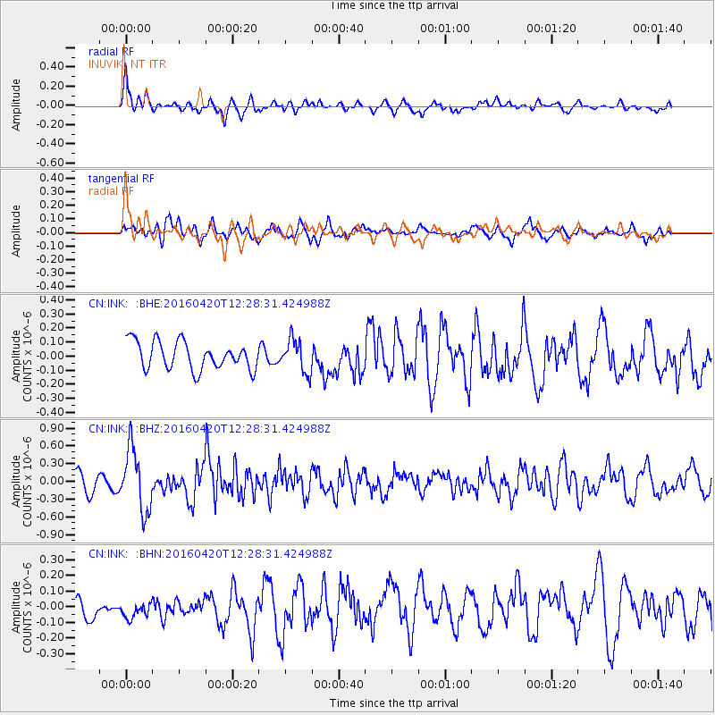
INK INUVIK, NT - Earthquake Result Viewer
*The percent match for this event was below the threshold and hence no stack was calculated.
| Earthquake location: |
Near East Coast Of Honshu, Japan |
| Earthquake latitude/longitude: |
37.8/141.6 |
| Earthquake time(UTC): |
2016/04/20 (111) 12:19:45 GMT |
| Earthquake Depth: |
41 km |
| Earthquake Magnitude: |
5.8 MB |
| Earthquake Catalog/Contributor: |
NEIC PDE/NEIC ALERT |
|
| Network: |
CN Canadian National Seismograph Network |
| Station: |
INK INUVIK, NT |
| Lat/Lon: |
68.31 N/133.53 W |
| Elevation: |
44 m |
|
| Distance: |
53.6 deg |
| Az: |
27.38 deg |
| Baz: |
281.563 deg |
| Ray Param: |
$rayparam |
*The percent match for this event was below the threshold and hence was not used in the summary stack. |
|
| Radial Match: |
66.94321 % |
| Radial Bump: |
400 |
| Transverse Match: |
66.124435 % |
| Transverse Bump: |
400 |
| SOD ConfigId: |
7422571 |
| Insert Time: |
2019-04-22 10:17:10.902 +0000 |
| GWidth: |
2.5 |
| Max Bumps: |
400 |
| Tol: |
0.001 |
|
Signal To Noise
| Channel | StoN | STA | LTA |
| CN:INK: :BHZ:20160420T12:28:31.424988Z | 3.9317613 | 5.3161716E-7 | 1.3521094E-7 |
| CN:INK: :BHN:20160420T12:28:31.424988Z | 0.89052534 | 6.588941E-8 | 7.398937E-8 |
| CN:INK: :BHE:20160420T12:28:31.424988Z | 1.203626 | 1.1683874E-7 | 9.7072295E-8 |
| Arrivals |
| Ps | |
| PpPs | |
| PsPs/PpSs | |


