WMOK Wichita Mountains, Oklahoma, USA - Earthquake Result Viewer
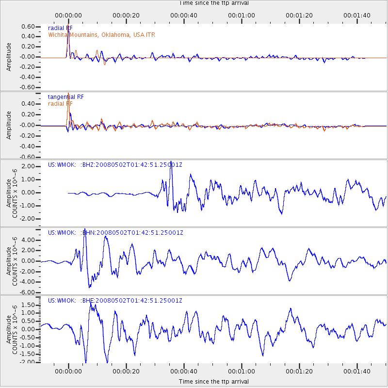
Earthquake location: Andreanof Islands, Aleutian Is.
Earthquake latitude/longitude: 51.9/-177.5
Earthquake time(UTC): 2008/05/02 (123) 01:33:37 GMT
Earthquake Depth: 14 km
Earthquake Magnitude: 6.3 MB, 6.8 MS, 6.6 MW, 6.6 MW
Earthquake Catalog/Contributor: WHDF/NEIC
Network: US United States National Seismic Network
Station: WMOK Wichita Mountains, Oklahoma, USA
Lat/Lon: 34.74 N/98.78 W
Elevation: 486 m
Distance: 57.0 deg
Az: 74.391 deg
Baz: 313.516 deg
Ray Param: 0.06376529
Estimated Moho Depth: 17.25 km
Estimated Crust Vp/Vs: 1.61
Assumed Crust Vp: 6.315 km/s
Estimated Crust Vs: 3.916 km/s
Estimated Crust Poisson's Ratio: 0.19
Radial Match: 95.43473 %
Radial Bump: 400
Transverse Match: 84.72298 %
Transverse Bump: 400
SOD ConfigId: 2504
Insert Time: 2010-03-05 02:02:06.139 +0000
GWidth: 2.5
Max Bumps: 400
Tol: 0.001

Signal To Noise

ChannelStoNSTALTA
US:WMOK: :BHN:20080502T01:42:51.25001Z6.48013641.0522326E-61.6237816E-7
US:WMOK: :BHE:20080502T01:42:51.25001Z2.13253214.3742088E-72.0511807E-7
US:WMOK: :BHZ:20080502T01:42:51.25001Z6.387834.6269517E-77.243386E-8
Arrivals
Ps1.8 SECOND
PpPs6.8 SECOND
PsPs/PpSs8.5 SECOND