WMOK Wichita Mountains, Oklahoma, USA - Earthquake Result Viewer
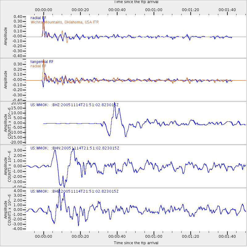
Earthquake location: Off East Coast Of Honshu, Japan
Earthquake latitude/longitude: 38.1/144.9
Earthquake time(UTC): 2005/11/14 (318) 21:38:51 GMT
Earthquake Depth: 11 km
Earthquake Magnitude: 6.7 MB, 6.8 MS, 7.0 MW, 6.9 MW
Earthquake Catalog/Contributor: WHDF/NEIC
Network: US United States National Seismic Network
Station: WMOK Wichita Mountains, Oklahoma, USA
Lat/Lon: 34.74 N/98.78 W
Elevation: 486 m
Distance: 86.5 deg
Az: 47.69 deg
Baz: 314.898 deg
Ray Param: 0.04398373
Estimated Moho Depth: 29.5 km
Estimated Crust Vp/Vs: 1.60
Assumed Crust Vp: 6.315 km/s
Estimated Crust Vs: 3.947 km/s
Estimated Crust Poisson's Ratio: 0.18
Radial Match: 97.73321 %
Radial Bump: 400
Transverse Match: 93.72686 %
Transverse Bump: 400
SOD ConfigId: 2448
Insert Time: 2010-03-05 02:02:45.794 +0000
GWidth: 2.5
Max Bumps: 400
Tol: 0.001

Signal To Noise

ChannelStoNSTALTA
US:WMOK: :BHN:20051114T21:51:02.823015Z2.54321894.5141874E-71.7749898E-7
US:WMOK: :BHE:20051114T21:51:02.823015Z5.51884137.428026E-71.3459395E-7
US:WMOK: :BHZ:20051114T21:51:02.823015Z23.7078972.654702E-61.1197544E-7
Arrivals
Ps2.9 SECOND
PpPs12 SECOND
PsPs/PpSs15 SECOND