You are here: Home > Network List > TA - USArray Transportable Network (new EarthScope stations) Stations List
> Station O03E Paynes Creek, CA, USA > Earthquake Result Viewer
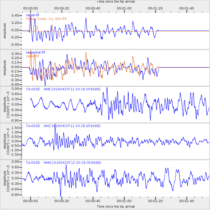
O03E Paynes Creek, CA, USA - Earthquake Result Viewer
*The percent match for this event was below the threshold and hence no stack was calculated.
| Earthquake location: |
Near East Coast Of Honshu, Japan |
| Earthquake latitude/longitude: |
37.8/141.6 |
| Earthquake time(UTC): |
2016/04/20 (111) 12:19:45 GMT |
| Earthquake Depth: |
41 km |
| Earthquake Magnitude: |
5.8 MB |
| Earthquake Catalog/Contributor: |
NEIC PDE/NEIC ALERT |
|
| Network: |
TA USArray Transportable Network (new EarthScope stations) |
| Station: |
O03E Paynes Creek, CA, USA |
| Lat/Lon: |
40.29 N/121.80 W |
| Elevation: |
967 m |
|
| Distance: |
71.1 deg |
| Az: |
53.416 deg |
| Baz: |
303.747 deg |
| Ray Param: |
$rayparam |
*The percent match for this event was below the threshold and hence was not used in the summary stack. |
|
| Radial Match: |
64.070694 % |
| Radial Bump: |
400 |
| Transverse Match: |
54.617805 % |
| Transverse Bump: |
400 |
| SOD ConfigId: |
7422571 |
| Insert Time: |
2019-04-22 10:22:23.320 +0000 |
| GWidth: |
2.5 |
| Max Bumps: |
400 |
| Tol: |
0.001 |
|
Signal To Noise
| Channel | StoN | STA | LTA |
| TA:O03E: :HHZ:20160420T12:30:28.059998Z | 1.8288018 | 3.6784058E-7 | 2.0113748E-7 |
| TA:O03E: :HHN:20160420T12:30:28.059998Z | 0.7758328 | 1.8947154E-7 | 2.4421698E-7 |
| TA:O03E: :HHE:20160420T12:30:28.059998Z | 1.149228 | 1.9519979E-7 | 1.6985297E-7 |
| Arrivals |
| Ps | |
| PpPs | |
| PsPs/PpSs | |


