WMOK Wichita Mountains, Oklahoma, USA - Earthquake Result Viewer
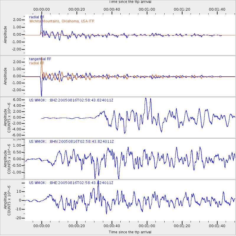
Earthquake location: Near East Coast Of Honshu, Japan
Earthquake latitude/longitude: 38.3/142.0
Earthquake time(UTC): 2005/08/16 (228) 02:46:28 GMT
Earthquake Depth: 36 km
Earthquake Magnitude: 6.5 MB, 6.8 MS, 7.2 MW, 7.1 MW
Earthquake Catalog/Contributor: WHDF/NEIC
Network: US United States National Seismic Network
Station: WMOK Wichita Mountains, Oklahoma, USA
Lat/Lon: 34.74 N/98.78 W
Elevation: 486 m
Distance: 88.1 deg
Az: 46.009 deg
Baz: 316.562 deg
Ray Param: 0.042820457
Estimated Moho Depth: 15.75 km
Estimated Crust Vp/Vs: 1.60
Assumed Crust Vp: 6.315 km/s
Estimated Crust Vs: 3.947 km/s
Estimated Crust Poisson's Ratio: 0.18
Radial Match: 97.0238 %
Radial Bump: 400
Transverse Match: 96.5926 %
Transverse Bump: 400
SOD ConfigId: 2475
Insert Time: 2010-03-05 02:02:47.173 +0000
GWidth: 2.5
Max Bumps: 400
Tol: 0.001

Signal To Noise

ChannelStoNSTALTA
US:WMOK: :BHN:20050816T02:58:43.824011Z1.29122381.175118E-79.100808E-8
US:WMOK: :BHE:20050816T02:58:43.824011Z6.47976543.2430094E-65.0048254E-7
US:WMOK: :BHZ:20050816T02:58:43.824011Z10.7647371.0484405E-69.739583E-8
Arrivals
Ps1.5 SECOND
PpPs6.3 SECOND
PsPs/PpSs7.9 SECOND