You are here: Home > Network List > TA - USArray Transportable Network (new EarthScope stations) Stations List
> Station T25A Trinidad, CO, USA > Earthquake Result Viewer
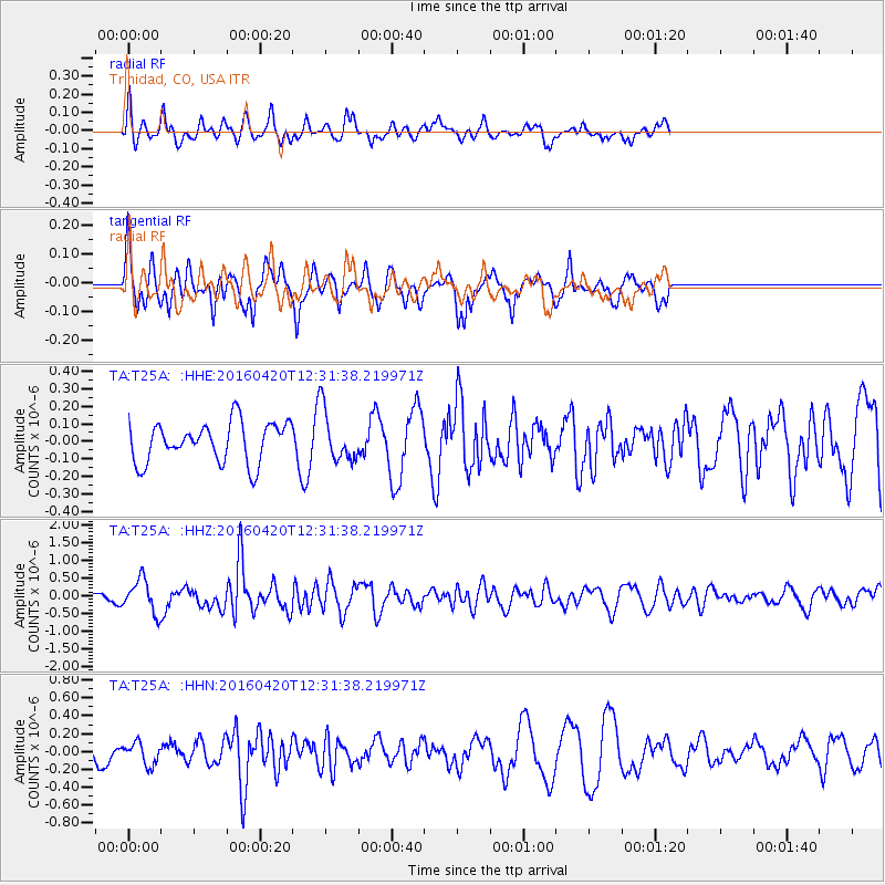
T25A Trinidad, CO, USA - Earthquake Result Viewer
*The percent match for this event was below the threshold and hence no stack was calculated.
| Earthquake location: |
Near East Coast Of Honshu, Japan |
| Earthquake latitude/longitude: |
37.8/141.6 |
| Earthquake time(UTC): |
2016/04/20 (111) 12:19:45 GMT |
| Earthquake Depth: |
41 km |
| Earthquake Magnitude: |
5.8 MB |
| Earthquake Catalog/Contributor: |
NEIC PDE/NEIC ALERT |
|
| Network: |
TA USArray Transportable Network (new EarthScope stations) |
| Station: |
T25A Trinidad, CO, USA |
| Lat/Lon: |
37.14 N/104.41 W |
| Elevation: |
2017 m |
|
| Distance: |
83.7 deg |
| Az: |
47.263 deg |
| Baz: |
313.285 deg |
| Ray Param: |
$rayparam |
*The percent match for this event was below the threshold and hence was not used in the summary stack. |
|
| Radial Match: |
65.8875 % |
| Radial Bump: |
400 |
| Transverse Match: |
69.733894 % |
| Transverse Bump: |
354 |
| SOD ConfigId: |
7422571 |
| Insert Time: |
2019-04-22 10:22:29.216 +0000 |
| GWidth: |
2.5 |
| Max Bumps: |
400 |
| Tol: |
0.001 |
|
Signal To Noise
| Channel | StoN | STA | LTA |
| TA:T25A: :HHZ:20160420T12:31:38.219971Z | 2.9501545 | 4.769023E-7 | 1.6165332E-7 |
| TA:T25A: :HHN:20160420T12:31:38.219971Z | 0.6669649 | 1.2174816E-7 | 1.8254059E-7 |
| TA:T25A: :HHE:20160420T12:31:38.219971Z | 1.1298518 | 1.2744573E-7 | 1.12798624E-7 |
| Arrivals |
| Ps | |
| PpPs | |
| PsPs/PpSs | |


