You are here: Home > Network List > US - United States National Seismic Network Stations List
> Station WMOK Wichita Mountains, Oklahoma, USA > Earthquake Result Viewer
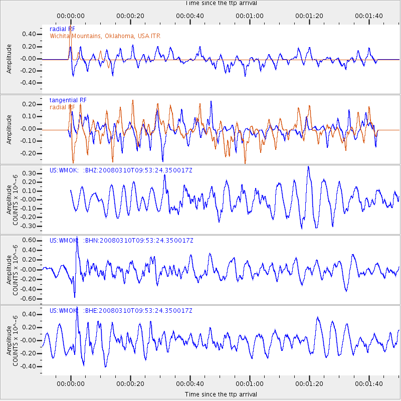
WMOK Wichita Mountains, Oklahoma, USA - Earthquake Result Viewer
*The percent match for this event was below the threshold and hence no stack was calculated.
| Earthquake location: |
Chile-Argentina Border Region |
| Earthquake latitude/longitude: |
-28.3/-69.3 |
| Earthquake time(UTC): |
2008/03/10 (070) 09:43:01 GMT |
| Earthquake Depth: |
90 km |
| Earthquake Magnitude: |
5.6 MB, 5.6 MW |
| Earthquake Catalog/Contributor: |
WHDF/NEIC |
|
| Network: |
US United States National Seismic Network |
| Station: |
WMOK Wichita Mountains, Oklahoma, USA |
| Lat/Lon: |
34.74 N/98.78 W |
| Elevation: |
486 m |
|
| Distance: |
68.6 deg |
| Az: |
334.199 deg |
| Baz: |
152.233 deg |
| Ray Param: |
$rayparam |
*The percent match for this event was below the threshold and hence was not used in the summary stack. |
|
| Radial Match: |
55.37224 % |
| Radial Bump: |
400 |
| Transverse Match: |
52.52724 % |
| Transverse Bump: |
400 |
| SOD ConfigId: |
2504 |
| Insert Time: |
2010-03-05 02:04:18.857 +0000 |
| GWidth: |
2.5 |
| Max Bumps: |
400 |
| Tol: |
0.001 |
|
Signal To Noise
| Channel | StoN | STA | LTA |
| US:WMOK: :BHN:20080310T09:53:24.350017Z | 2.6158803 | 2.8191278E-7 | 1.0776976E-7 |
| US:WMOK: :BHE:20080310T09:53:24.350017Z | 1.5448061 | 2.2214752E-7 | 1.4380285E-7 |
| US:WMOK: :BHZ:20080310T09:53:24.350017Z | 1.190184 | 1.261881E-7 | 1.0602403E-7 |
| Arrivals |
| Ps | |
| PpPs | |
| PsPs/PpSs | |


