You are here: Home > Network List > US - United States National Seismic Network Stations List
> Station WMOK Wichita Mountains, Oklahoma, USA > Earthquake Result Viewer
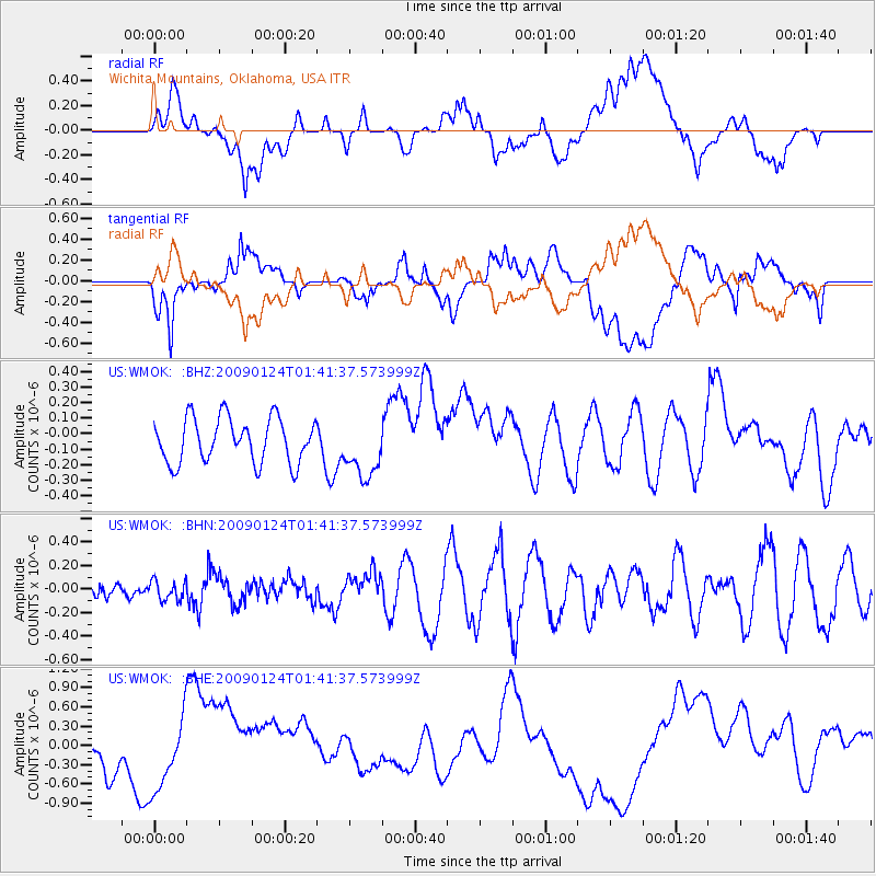
WMOK Wichita Mountains, Oklahoma, USA - Earthquake Result Viewer
*The percent match for this event was below the threshold and hence no stack was calculated.
| Earthquake location: |
Kermadec Islands Region |
| Earthquake latitude/longitude: |
-28.2/-176.7 |
| Earthquake time(UTC): |
2009/01/24 (024) 01:28:39 GMT |
| Earthquake Depth: |
10 km |
| Earthquake Magnitude: |
5.5 MB, 5.8 MS, 6.0 MW, 5.8 MW |
| Earthquake Catalog/Contributor: |
WHDF/NEIC |
|
| Network: |
US United States National Seismic Network |
| Station: |
WMOK Wichita Mountains, Oklahoma, USA |
| Lat/Lon: |
34.74 N/98.78 W |
| Elevation: |
486 m |
|
| Distance: |
96.6 deg |
| Az: |
54.163 deg |
| Baz: |
240.276 deg |
| Ray Param: |
$rayparam |
*The percent match for this event was below the threshold and hence was not used in the summary stack. |
|
| Radial Match: |
27.710846 % |
| Radial Bump: |
400 |
| Transverse Match: |
31.44776 % |
| Transverse Bump: |
400 |
| SOD ConfigId: |
2658 |
| Insert Time: |
2010-03-05 02:04:21.216 +0000 |
| GWidth: |
2.5 |
| Max Bumps: |
400 |
| Tol: |
0.001 |
|
Signal To Noise
| Channel | StoN | STA | LTA |
| US:WMOK: :BHN:20090124T01:41:37.573999Z | 0.6765905 | 8.103956E-8 | 1.1977637E-7 |
| US:WMOK: :BHE:20090124T01:41:37.573999Z | 1.8079683 | 5.0167745E-7 | 2.7748132E-7 |
| US:WMOK: :BHZ:20090124T01:41:37.573999Z | 1.3045946 | 1.8664785E-7 | 1.430696E-7 |
| Arrivals |
| Ps | |
| PpPs | |
| PsPs/PpSs | |


