You are here: Home > Network List > US - United States National Seismic Network Stations List
> Station WMOK Wichita Mountains, Oklahoma, USA > Earthquake Result Viewer
WMOK Wichita Mountains, Oklahoma, USA - Earthquake Result Viewer
*The percent match for this event was below the threshold and hence no stack was calculated.
| Earthquake location: |
Rat Islands, Aleutian Islands |
| Earthquake latitude/longitude: |
51.2/178.8 |
| Earthquake time(UTC): |
2008/05/20 (141) 13:53:35 GMT |
| Earthquake Depth: |
27 km |
| Earthquake Magnitude: |
5.8 MB, 6.0 MS, 6.3 MW, 6.3 MW |
| Earthquake Catalog/Contributor: |
WHDF/NEIC |
|
| Network: |
US United States National Seismic Network |
| Station: |
WMOK Wichita Mountains, Oklahoma, USA |
| Lat/Lon: |
34.74 N/98.78 W |
| Elevation: |
486 m |
|
| Distance: |
59.4 deg |
| Az: |
71.497 deg |
| Baz: |
313.526 deg |
| Ray Param: |
$rayparam |
*The percent match for this event was below the threshold and hence was not used in the summary stack. |
|
| Radial Match: |
57.91157 % |
| Radial Bump: |
400 |
| Transverse Match: |
50.896492 % |
| Transverse Bump: |
400 |
| SOD ConfigId: |
2504 |
| Insert Time: |
2010-03-05 02:04:33.333 +0000 |
| GWidth: |
2.5 |
| Max Bumps: |
400 |
| Tol: |
0.001 |
|
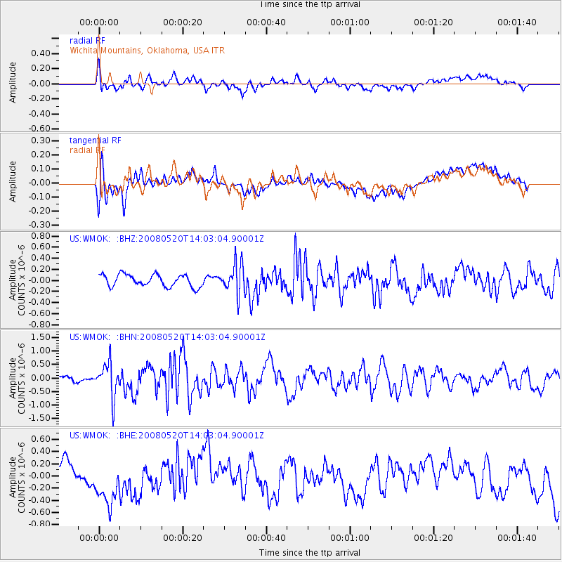
Signal To Noise
| Channel | StoN | STA | LTA |
| US:WMOK: :BHN:20080520T14:03:04.90001Z | 5.3682733 | 6.477214E-7 | 1.206573E-7 |
| US:WMOK: :BHE:20080520T14:03:04.90001Z | 1.5863291 | 4.1353368E-7 | 2.6068594E-7 |
| US:WMOK: :BHZ:20080520T14:03:04.90001Z | 2.500892 | 2.7102016E-7 | 1.0836939E-7 |
| Arrivals |
| Ps | |
| PpPs | |
| PsPs/PpSs | |


