You are here: Home > Network List > US - United States National Seismic Network Stations List
> Station WMOK Wichita Mountains, Oklahoma, USA > Earthquake Result Viewer
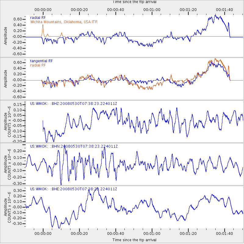
WMOK Wichita Mountains, Oklahoma, USA - Earthquake Result Viewer
*The percent match for this event was below the threshold and hence no stack was calculated.
| Earthquake location: |
Southeast Of Honshu, Japan |
| Earthquake latitude/longitude: |
30.8/141.5 |
| Earthquake time(UTC): |
2008/05/30 (151) 07:25:39 GMT |
| Earthquake Depth: |
16 km |
| Earthquake Magnitude: |
5.5 MB, 5.5 MS, 5.8 MW, 5.7 MW |
| Earthquake Catalog/Contributor: |
WHDF/NEIC |
|
| Network: |
US United States National Seismic Network |
| Station: |
WMOK Wichita Mountains, Oklahoma, USA |
| Lat/Lon: |
34.74 N/98.78 W |
| Elevation: |
486 m |
|
| Distance: |
93.6 deg |
| Az: |
45.789 deg |
| Baz: |
311.506 deg |
| Ray Param: |
$rayparam |
*The percent match for this event was below the threshold and hence was not used in the summary stack. |
|
| Radial Match: |
37.89736 % |
| Radial Bump: |
400 |
| Transverse Match: |
30.213839 % |
| Transverse Bump: |
400 |
| SOD ConfigId: |
2504 |
| Insert Time: |
2010-03-05 02:04:36.078 +0000 |
| GWidth: |
2.5 |
| Max Bumps: |
400 |
| Tol: |
0.001 |
|
Signal To Noise
| Channel | StoN | STA | LTA |
| US:WMOK: :BHN:20080530T07:38:23.224011Z | 0.99715376 | 7.2486394E-8 | 7.269329E-8 |
| US:WMOK: :BHE:20080530T07:38:23.224011Z | 1.3920921 | 1.8675337E-7 | 1.3415303E-7 |
| US:WMOK: :BHZ:20080530T07:38:23.224011Z | 2.1925628 | 1.4550035E-7 | 6.6360855E-8 |
| Arrivals |
| Ps | |
| PpPs | |
| PsPs/PpSs | |


