You are here: Home > Network List > US - United States National Seismic Network Stations List
> Station WMOK Wichita Mountains, Oklahoma, USA > Earthquake Result Viewer
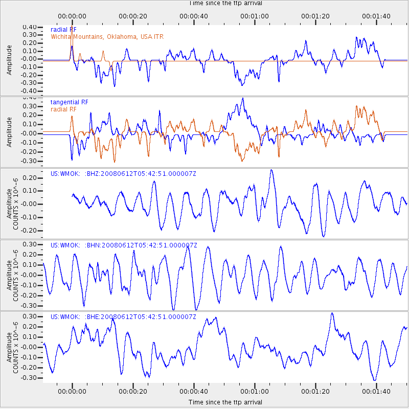
WMOK Wichita Mountains, Oklahoma, USA - Earthquake Result Viewer
*The percent match for this event was below the threshold and hence no stack was calculated.
| Earthquake location: |
Southern East Pacific Rise |
| Earthquake latitude/longitude: |
-50.2/-114.2 |
| Earthquake time(UTC): |
2008/06/12 (164) 05:30:43 GMT |
| Earthquake Depth: |
10 km |
| Earthquake Magnitude: |
5.6 MS, 5.3 MB, 5.9 MW, 5.9 MW |
| Earthquake Catalog/Contributor: |
WHDF/NEIC |
|
| Network: |
US United States National Seismic Network |
| Station: |
WMOK Wichita Mountains, Oklahoma, USA |
| Lat/Lon: |
34.74 N/98.78 W |
| Elevation: |
486 m |
|
| Distance: |
85.6 deg |
| Az: |
12.661 deg |
| Baz: |
189.857 deg |
| Ray Param: |
$rayparam |
*The percent match for this event was below the threshold and hence was not used in the summary stack. |
|
| Radial Match: |
31.151474 % |
| Radial Bump: |
400 |
| Transverse Match: |
46.469654 % |
| Transverse Bump: |
400 |
| SOD ConfigId: |
2504 |
| Insert Time: |
2010-03-05 02:04:39.382 +0000 |
| GWidth: |
2.5 |
| Max Bumps: |
400 |
| Tol: |
0.001 |
|
Signal To Noise
| Channel | StoN | STA | LTA |
| US:WMOK: :BHN:20080612T05:42:51.000007Z | 1.6218587 | 1.6098629E-7 | 9.926037E-8 |
| US:WMOK: :BHE:20080612T05:42:51.000007Z | 2.3451514 | 2.194105E-7 | 9.3559194E-8 |
| US:WMOK: :BHZ:20080612T05:42:51.000007Z | 2.5942404 | 1.2473785E-7 | 4.808261E-8 |
| Arrivals |
| Ps | |
| PpPs | |
| PsPs/PpSs | |


