You are here: Home > Network List > US - United States National Seismic Network Stations List
> Station WMOK Wichita Mountains, Oklahoma, USA > Earthquake Result Viewer
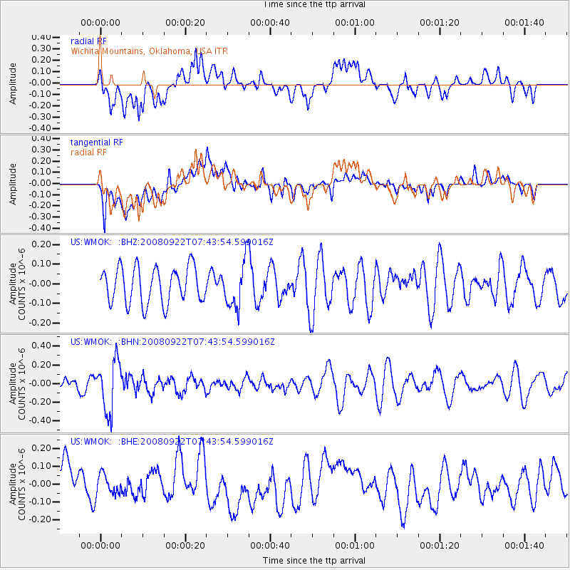
WMOK Wichita Mountains, Oklahoma, USA - Earthquake Result Viewer
*The percent match for this event was below the threshold and hence no stack was calculated.
| Earthquake location: |
Hokkaido, Japan Region |
| Earthquake latitude/longitude: |
41.6/140.4 |
| Earthquake time(UTC): |
2008/09/22 (266) 07:31:59 GMT |
| Earthquake Depth: |
149 km |
| Earthquake Magnitude: |
5.7 MW, 5.3 MB, 5.6 MW |
| Earthquake Catalog/Contributor: |
WHDF/NEIC |
|
| Network: |
US United States National Seismic Network |
| Station: |
WMOK Wichita Mountains, Oklahoma, USA |
| Lat/Lon: |
34.74 N/98.78 W |
| Elevation: |
486 m |
|
| Distance: |
86.6 deg |
| Az: |
45.142 deg |
| Baz: |
319.776 deg |
| Ray Param: |
$rayparam |
*The percent match for this event was below the threshold and hence was not used in the summary stack. |
|
| Radial Match: |
44.00777 % |
| Radial Bump: |
400 |
| Transverse Match: |
53.926914 % |
| Transverse Bump: |
400 |
| SOD ConfigId: |
2560 |
| Insert Time: |
2010-03-05 02:04:58.362 +0000 |
| GWidth: |
2.5 |
| Max Bumps: |
400 |
| Tol: |
0.001 |
|
Signal To Noise
| Channel | StoN | STA | LTA |
| US:WMOK: :BHN:20080922T07:43:54.599016Z | 3.8856618 | 2.7383282E-7 | 7.047264E-8 |
| US:WMOK: :BHE:20080922T07:43:54.599016Z | 0.4109343 | 5.525188E-8 | 1.344543E-7 |
| US:WMOK: :BHZ:20080922T07:43:54.599016Z | 1.331784 | 1.2179079E-7 | 9.144935E-8 |
| Arrivals |
| Ps | |
| PpPs | |
| PsPs/PpSs | |


