You are here: Home > Network List > US - United States National Seismic Network Stations List
> Station WMOK Wichita Mountains, Oklahoma, USA > Earthquake Result Viewer
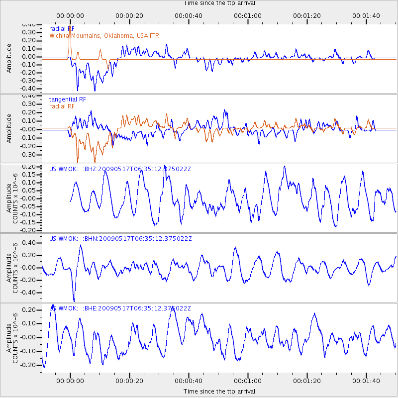
WMOK Wichita Mountains, Oklahoma, USA - Earthquake Result Viewer
*The percent match for this event was below the threshold and hence no stack was calculated.
| Earthquake location: |
Tonga Islands |
| Earthquake latitude/longitude: |
-16.8/-173.5 |
| Earthquake time(UTC): |
2009/05/17 (137) 06:23:03 GMT |
| Earthquake Depth: |
67 km |
| Earthquake Magnitude: |
5.5 MB, 5.6 MW, 5.6 MW |
| Earthquake Catalog/Contributor: |
WHDF/NEIC |
|
| Network: |
US United States National Seismic Network |
| Station: |
WMOK Wichita Mountains, Oklahoma, USA |
| Lat/Lon: |
34.74 N/98.78 W |
| Elevation: |
486 m |
|
| Distance: |
87.4 deg |
| Az: |
52.674 deg |
| Baz: |
247.632 deg |
| Ray Param: |
$rayparam |
*The percent match for this event was below the threshold and hence was not used in the summary stack. |
|
| Radial Match: |
57.007267 % |
| Radial Bump: |
400 |
| Transverse Match: |
55.820583 % |
| Transverse Bump: |
400 |
| SOD ConfigId: |
2760 |
| Insert Time: |
2010-03-05 02:05:00.993 +0000 |
| GWidth: |
2.5 |
| Max Bumps: |
400 |
| Tol: |
0.001 |
|
Signal To Noise
| Channel | StoN | STA | LTA |
| US:WMOK: :BHN:20090517T06:35:12.375022Z | 1.9248141 | 2.4686076E-7 | 1.2825174E-7 |
| US:WMOK: :BHE:20090517T06:35:12.375022Z | 0.843607 | 7.603024E-8 | 9.012519E-8 |
| US:WMOK: :BHZ:20090517T06:35:12.375022Z | 1.388528 | 1.1665999E-7 | 8.401702E-8 |
| Arrivals |
| Ps | |
| PpPs | |
| PsPs/PpSs | |


