You are here: Home > Network List > US - United States National Seismic Network Stations List
> Station WMOK Wichita Mountains, Oklahoma, USA > Earthquake Result Viewer
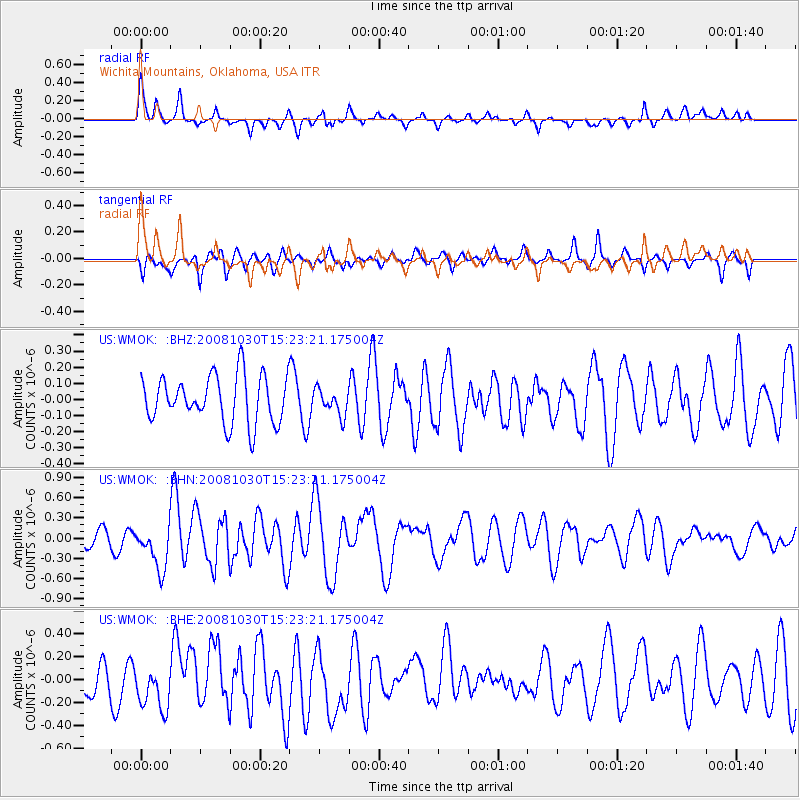
WMOK Wichita Mountains, Oklahoma, USA - Earthquake Result Viewer
*The percent match for this event was below the threshold and hence no stack was calculated.
| Earthquake location: |
Central East Pacific Rise |
| Earthquake latitude/longitude: |
-9.0/-108.2 |
| Earthquake time(UTC): |
2008/10/30 (304) 15:15:41 GMT |
| Earthquake Depth: |
10 km |
| Earthquake Magnitude: |
5.5 MB, 5.8 MS, 6.0 MW, 6.0 MW |
| Earthquake Catalog/Contributor: |
WHDF/NEIC |
|
| Network: |
US United States National Seismic Network |
| Station: |
WMOK Wichita Mountains, Oklahoma, USA |
| Lat/Lon: |
34.74 N/98.78 W |
| Elevation: |
486 m |
|
| Distance: |
44.4 deg |
| Az: |
11.154 deg |
| Baz: |
193.417 deg |
| Ray Param: |
$rayparam |
*The percent match for this event was below the threshold and hence was not used in the summary stack. |
|
| Radial Match: |
67.0379 % |
| Radial Bump: |
400 |
| Transverse Match: |
63.119637 % |
| Transverse Bump: |
400 |
| SOD ConfigId: |
2560 |
| Insert Time: |
2010-03-05 02:05:06.798 +0000 |
| GWidth: |
2.5 |
| Max Bumps: |
400 |
| Tol: |
0.001 |
|
Signal To Noise
| Channel | StoN | STA | LTA |
| US:WMOK: :BHN:20081030T15:23:21.175004Z | 2.129969 | 3.252846E-7 | 1.5271799E-7 |
| US:WMOK: :BHE:20081030T15:23:21.175004Z | 1.566823 | 2.19668E-7 | 1.4019963E-7 |
| US:WMOK: :BHZ:20081030T15:23:21.175004Z | 0.5514227 | 8.0192784E-8 | 1.4542887E-7 |
| Arrivals |
| Ps | |
| PpPs | |
| PsPs/PpSs | |


