You are here: Home > Network List > US - United States National Seismic Network Stations List
> Station WMOK Wichita Mountains, Oklahoma, USA > Earthquake Result Viewer
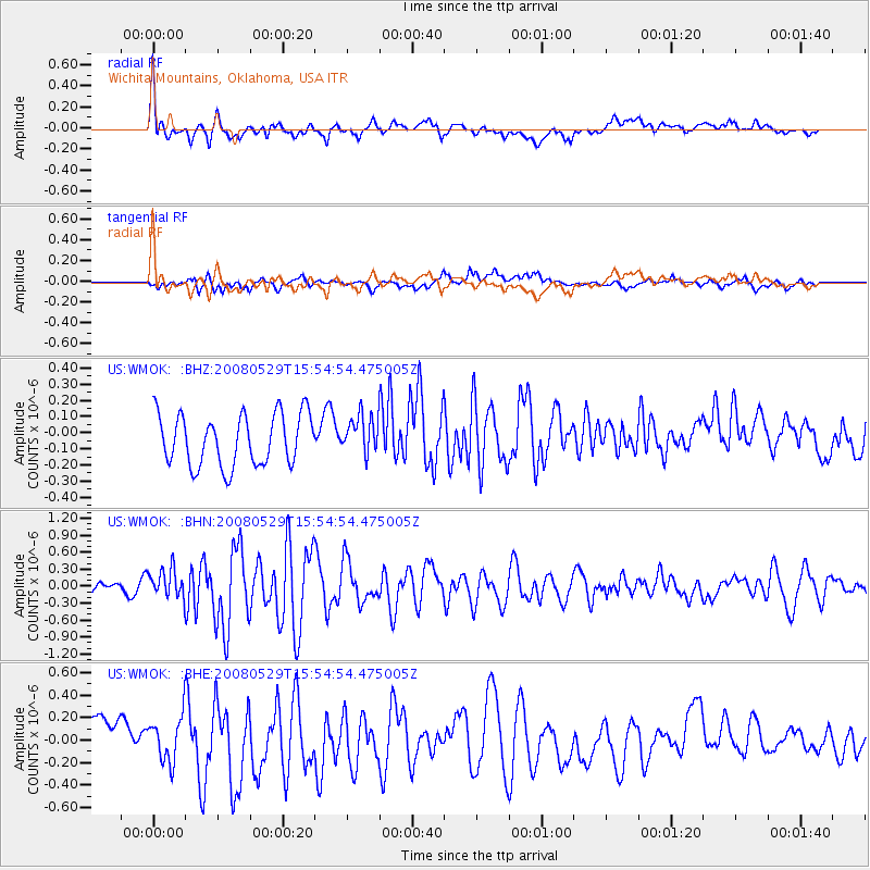
WMOK Wichita Mountains, Oklahoma, USA - Earthquake Result Viewer
*The percent match for this event was below the threshold and hence no stack was calculated.
| Earthquake location: |
Iceland |
| Earthquake latitude/longitude: |
64.0/-21.0 |
| Earthquake time(UTC): |
2008/05/29 (150) 15:46:00 GMT |
| Earthquake Depth: |
10 km |
| Earthquake Magnitude: |
6.0 MB, 6.2 MS, 6.3 MW, 6.2 MW |
| Earthquake Catalog/Contributor: |
WHDF/NEIC |
|
| Network: |
US United States National Seismic Network |
| Station: |
WMOK Wichita Mountains, Oklahoma, USA |
| Lat/Lon: |
34.74 N/98.78 W |
| Elevation: |
486 m |
|
| Distance: |
54.1 deg |
| Az: |
276.616 deg |
| Baz: |
32.11 deg |
| Ray Param: |
$rayparam |
*The percent match for this event was below the threshold and hence was not used in the summary stack. |
|
| Radial Match: |
58.645138 % |
| Radial Bump: |
400 |
| Transverse Match: |
60.636192 % |
| Transverse Bump: |
400 |
| SOD ConfigId: |
2504 |
| Insert Time: |
2010-03-05 02:05:11.201 +0000 |
| GWidth: |
2.5 |
| Max Bumps: |
400 |
| Tol: |
0.001 |
|
Signal To Noise
| Channel | StoN | STA | LTA |
| US:WMOK: :BHN:20080529T15:54:54.475005Z | 2.4974847 | 2.4942094E-7 | 9.986886E-8 |
| US:WMOK: :BHE:20080529T15:54:54.475005Z | 1.2110618 | 2.0163002E-7 | 1.6649027E-7 |
| US:WMOK: :BHZ:20080529T15:54:54.475005Z | 0.7612676 | 1.2060974E-7 | 1.5843278E-7 |
| Arrivals |
| Ps | |
| PpPs | |
| PsPs/PpSs | |


