You are here: Home > Network List > TA - USArray Transportable Network (new EarthScope stations) Stations List
> Station J20K Nowitna River, AK, USA > Earthquake Result Viewer
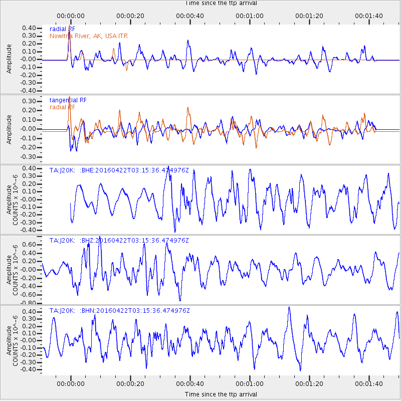
J20K Nowitna River, AK, USA - Earthquake Result Viewer
*The percent match for this event was below the threshold and hence no stack was calculated.
| Earthquake location: |
Near Coast Of Ecuador |
| Earthquake latitude/longitude: |
-0.3/-80.5 |
| Earthquake time(UTC): |
2016/04/22 (113) 03:03:42 GMT |
| Earthquake Depth: |
10 km |
| Earthquake Magnitude: |
6.0 MO |
| Earthquake Catalog/Contributor: |
NEIC PDE/NEIC ALERT |
|
| Network: |
TA USArray Transportable Network (new EarthScope stations) |
| Station: |
J20K Nowitna River, AK, USA |
| Lat/Lon: |
64.18 N/154.15 W |
| Elevation: |
314 m |
|
| Distance: |
83.2 deg |
| Az: |
334.967 deg |
| Baz: |
104.956 deg |
| Ray Param: |
$rayparam |
*The percent match for this event was below the threshold and hence was not used in the summary stack. |
|
| Radial Match: |
68.98954 % |
| Radial Bump: |
400 |
| Transverse Match: |
70.083725 % |
| Transverse Bump: |
400 |
| SOD ConfigId: |
7422571 |
| Insert Time: |
2019-04-22 10:34:46.826 +0000 |
| GWidth: |
2.5 |
| Max Bumps: |
400 |
| Tol: |
0.001 |
|
Signal To Noise
| Channel | StoN | STA | LTA |
| TA:J20K: :BHZ:20160422T03:15:36.474976Z | 3.1708713 | 3.2785752E-7 | 1.03396665E-7 |
| TA:J20K: :BHN:20160422T03:15:36.474976Z | 0.56833214 | 6.913864E-8 | 1.2165184E-7 |
| TA:J20K: :BHE:20160422T03:15:36.474976Z | 2.1155858 | 2.7109348E-7 | 1.281411E-7 |
| Arrivals |
| Ps | |
| PpPs | |
| PsPs/PpSs | |


