You are here: Home > Network List > TA - USArray Transportable Network (new EarthScope stations) Stations List
> Station J26L Joseph Creek, AK, USA > Earthquake Result Viewer
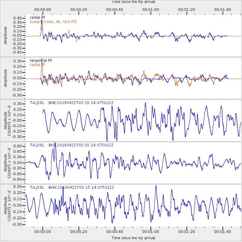
J26L Joseph Creek, AK, USA - Earthquake Result Viewer
*The percent match for this event was below the threshold and hence no stack was calculated.
| Earthquake location: |
Near Coast Of Ecuador |
| Earthquake latitude/longitude: |
-0.3/-80.5 |
| Earthquake time(UTC): |
2016/04/22 (113) 03:03:42 GMT |
| Earthquake Depth: |
10 km |
| Earthquake Magnitude: |
6.0 MO |
| Earthquake Catalog/Contributor: |
NEIC PDE/NEIC ALERT |
|
| Network: |
TA USArray Transportable Network (new EarthScope stations) |
| Station: |
J26L Joseph Creek, AK, USA |
| Lat/Lon: |
64.50 N/143.56 W |
| Elevation: |
1144 m |
|
| Distance: |
79.0 deg |
| Az: |
336.859 deg |
| Baz: |
114.781 deg |
| Ray Param: |
$rayparam |
*The percent match for this event was below the threshold and hence was not used in the summary stack. |
|
| Radial Match: |
74.571014 % |
| Radial Bump: |
400 |
| Transverse Match: |
54.93619 % |
| Transverse Bump: |
400 |
| SOD ConfigId: |
7422571 |
| Insert Time: |
2019-04-22 10:34:48.108 +0000 |
| GWidth: |
2.5 |
| Max Bumps: |
400 |
| Tol: |
0.001 |
|
Signal To Noise
| Channel | StoN | STA | LTA |
| TA:J26L: :BHZ:20160422T03:15:14.075012Z | 4.8235383 | 4.840754E-7 | 1.0035691E-7 |
| TA:J26L: :BHN:20160422T03:15:14.075012Z | 1.2177935 | 1.1592107E-7 | 9.5189435E-8 |
| TA:J26L: :BHE:20160422T03:15:14.075012Z | 1.1808523 | 1.3516859E-7 | 1.1446697E-7 |
| Arrivals |
| Ps | |
| PpPs | |
| PsPs/PpSs | |


