You are here: Home > Network List > US - United States National Seismic Network Stations List
> Station WMOK Wichita Mountains, Oklahoma, USA > Earthquake Result Viewer
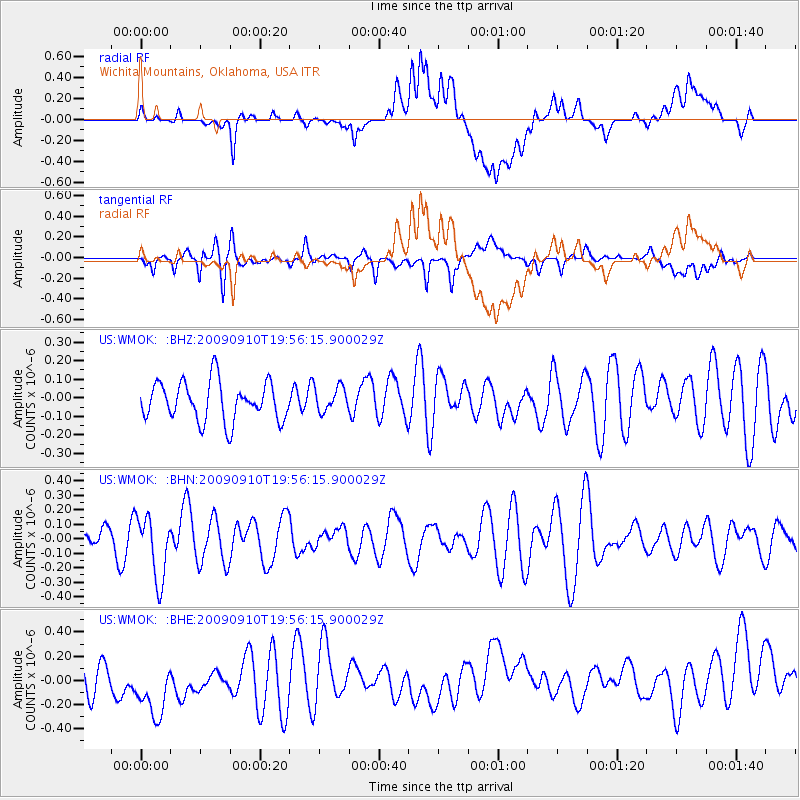
WMOK Wichita Mountains, Oklahoma, USA - Earthquake Result Viewer
*The percent match for this event was below the threshold and hence no stack was calculated.
| Earthquake location: |
Easter Island Region |
| Earthquake latitude/longitude: |
-29.9/-111.8 |
| Earthquake time(UTC): |
2009/09/10 (253) 19:46:03 GMT |
| Earthquake Depth: |
10 km |
| Earthquake Magnitude: |
5.5 MW, 5.4 MB |
| Earthquake Catalog/Contributor: |
WHDF/NEIC |
|
| Network: |
US United States National Seismic Network |
| Station: |
WMOK Wichita Mountains, Oklahoma, USA |
| Lat/Lon: |
34.74 N/98.78 W |
| Elevation: |
486 m |
|
| Distance: |
65.5 deg |
| Az: |
11.787 deg |
| Baz: |
192.435 deg |
| Ray Param: |
$rayparam |
*The percent match for this event was below the threshold and hence was not used in the summary stack. |
|
| Radial Match: |
33.202816 % |
| Radial Bump: |
400 |
| Transverse Match: |
49.884735 % |
| Transverse Bump: |
400 |
| SOD ConfigId: |
2622 |
| Insert Time: |
2010-03-05 02:05:44.162 +0000 |
| GWidth: |
2.5 |
| Max Bumps: |
400 |
| Tol: |
0.001 |
|
Signal To Noise
| Channel | StoN | STA | LTA |
| US:WMOK: :BHN:20090910T19:56:15.900029Z | 2.0398197 | 2.1914113E-7 | 1.0743162E-7 |
| US:WMOK: :BHE:20090910T19:56:15.900029Z | 3.2550354 | 2.717539E-7 | 8.348723E-8 |
| US:WMOK: :BHZ:20090910T19:56:15.900029Z | 0.62472874 | 6.5419286E-8 | 1.0471631E-7 |
| Arrivals |
| Ps | |
| PpPs | |
| PsPs/PpSs | |


