You are here: Home > Network List > UW - Pacific Northwest Regional Seismic Network Stations List
> Station LEBA Lebam, WA, USA > Earthquake Result Viewer
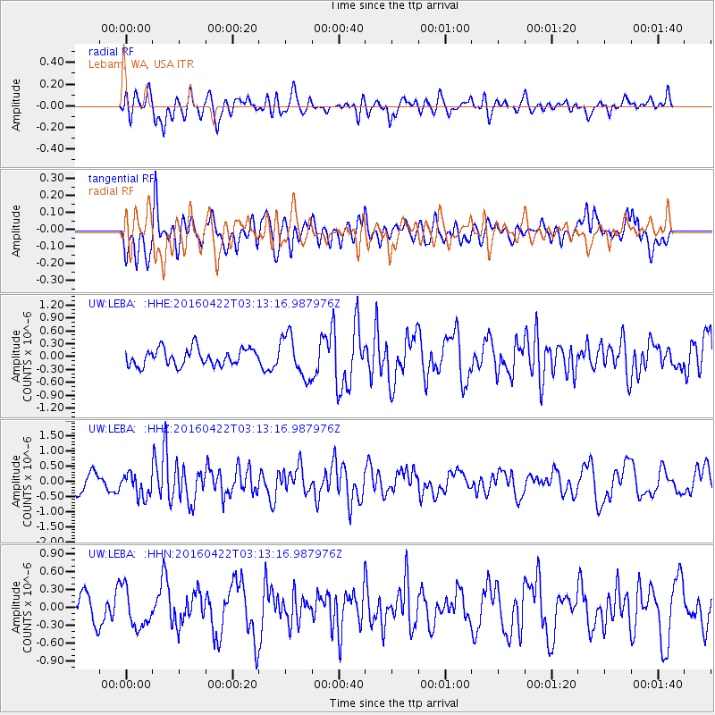
LEBA Lebam, WA, USA - Earthquake Result Viewer
*The percent match for this event was below the threshold and hence no stack was calculated.
| Earthquake location: |
Near Coast Of Ecuador |
| Earthquake latitude/longitude: |
-0.3/-80.5 |
| Earthquake time(UTC): |
2016/04/22 (113) 03:03:42 GMT |
| Earthquake Depth: |
10 km |
| Earthquake Magnitude: |
6.0 MO |
| Earthquake Catalog/Contributor: |
NEIC PDE/NEIC ALERT |
|
| Network: |
UW Pacific Northwest Regional Seismic Network |
| Station: |
LEBA Lebam, WA, USA |
| Lat/Lon: |
46.55 N/123.56 W |
| Elevation: |
73 m |
|
| Distance: |
60.0 deg |
| Az: |
327.049 deg |
| Baz: |
127.996 deg |
| Ray Param: |
$rayparam |
*The percent match for this event was below the threshold and hence was not used in the summary stack. |
|
| Radial Match: |
54.477768 % |
| Radial Bump: |
400 |
| Transverse Match: |
49.271862 % |
| Transverse Bump: |
400 |
| SOD ConfigId: |
7422571 |
| Insert Time: |
2019-04-22 10:35:52.326 +0000 |
| GWidth: |
2.5 |
| Max Bumps: |
400 |
| Tol: |
0.001 |
|
Signal To Noise
| Channel | StoN | STA | LTA |
| UW:LEBA: :HHZ:20160422T03:13:16.987976Z | 1.2564137 | 3.886159E-7 | 3.0930568E-7 |
| UW:LEBA: :HHN:20160422T03:13:16.987976Z | 1.5188242 | 3.1829452E-7 | 2.095664E-7 |
| UW:LEBA: :HHE:20160422T03:13:16.987976Z | 2.5394118 | 4.9822216E-7 | 1.9619588E-7 |
| Arrivals |
| Ps | |
| PpPs | |
| PsPs/PpSs | |


