You are here: Home > Network List > US - United States National Seismic Network Stations List
> Station WMOK Wichita Mountains, Oklahoma, USA > Earthquake Result Viewer
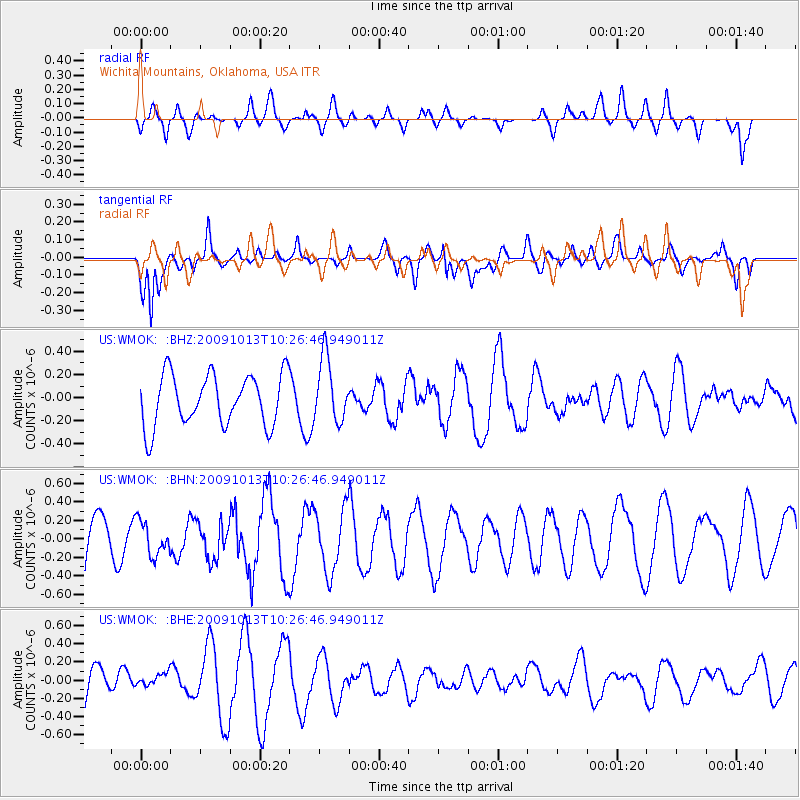
WMOK Wichita Mountains, Oklahoma, USA - Earthquake Result Viewer
*The percent match for this event was below the threshold and hence no stack was calculated.
| Earthquake location: |
Kuril Islands |
| Earthquake latitude/longitude: |
44.6/149.1 |
| Earthquake time(UTC): |
2009/10/13 (286) 10:15:13 GMT |
| Earthquake Depth: |
40 km |
| Earthquake Magnitude: |
5.6 MB, 5.2 MS, 5.7 MW, 5.6 MW |
| Earthquake Catalog/Contributor: |
WHDF/NEIC |
|
| Network: |
US United States National Seismic Network |
| Station: |
WMOK Wichita Mountains, Oklahoma, USA |
| Lat/Lon: |
34.74 N/98.78 W |
| Elevation: |
486 m |
|
| Distance: |
79.9 deg |
| Az: |
50.816 deg |
| Baz: |
317.73 deg |
| Ray Param: |
$rayparam |
*The percent match for this event was below the threshold and hence was not used in the summary stack. |
|
| Radial Match: |
48.983955 % |
| Radial Bump: |
400 |
| Transverse Match: |
68.068504 % |
| Transverse Bump: |
400 |
| SOD ConfigId: |
2622 |
| Insert Time: |
2010-03-05 02:05:50.151 +0000 |
| GWidth: |
2.5 |
| Max Bumps: |
400 |
| Tol: |
0.001 |
|
Signal To Noise
| Channel | StoN | STA | LTA |
| US:WMOK: :BHN:20091013T10:26:46.949011Z | 0.61265755 | 1.8179043E-7 | 2.9672438E-7 |
| US:WMOK: :BHE:20091013T10:26:46.949011Z | 0.45974985 | 8.271076E-8 | 1.7990384E-7 |
| US:WMOK: :BHZ:20091013T10:26:46.949011Z | 1.2473375 | 2.7651507E-7 | 2.2168426E-7 |
| Arrivals |
| Ps | |
| PpPs | |
| PsPs/PpSs | |


